
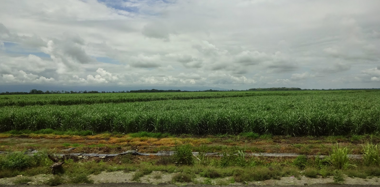
Moving northward past Mount Chimborazo to the West, on the central plains or main valley of the Central Cordillera—the highest of the Andean mountain ranges—toward Ambato, and the Ambato River, which has cut a deep basin into the land, an oceanic climate area north of Riobamba, the latter the likely location of the Jaredite kingdom seat of Moron, Omer and his family and household would have been heading northward toward Latacunga. Today, these plains are famous for the Guaytambo, a native green-skinned peach grown in the temperate dry valley that tastes more like a hard nectarine.
The hill of Shim, 15,000-foot Mount Hermoso in Ecuador
It might be of note that this 15,190-foot mountain is considered both a magical place and the location of where much gold from the Inca Atahualpas treasure has been buried, perhaps among the many caves located along the lower part and base of the mount. The Cerro Hermoso is the central mountain of the Llanganati mountain range, which is not exactly a mountain range but a rare system of three clustered mountain ranges, embedded in a part of the inter-Andean valley and emerging as branches of the Third Cordillera of the Ecuadorian Andes, and an unsafe area to climb around because of its mysterious vegetation. Here the mosses grow so great that they sink into and cover large crevices and abysses, where unsuspecting people can fall into without notice, which has led to numerous legends and myths about the hill, making it a perfect place for Ammaron to hide the records that would not have been bothered at the time.
When Omer passed through the Quito Valley, often called the Quito Bowl or Quito Basin—and likely the location of the Valley of Gilgal, where Coriantumr and Shared fought their battles that ended in the latter’s death—there would have been several paths he could have taken. Of these several passes that move out of the basin include the route he took from the south to reach this valley, that passed by the hill of Shim (Ether 9:3), which would likely have been the hill Cerro Hermoso (hill beautiful), through the Plains of Agosh along the Latacunga plateau, where today is located the city of Latacunga near the confluence of the Alaquez and Cutuchi rivers near the headwaters of the Pastaza river.
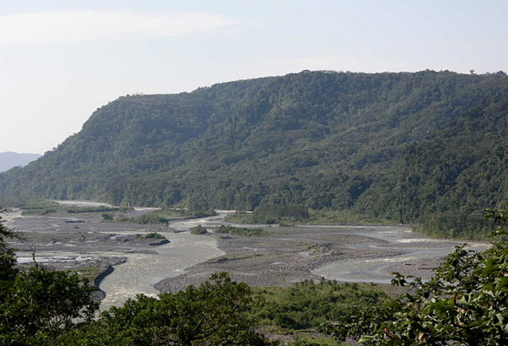
Headwaters of the Pastaza River just south of modern-day Quito in the Valley Basin
The Calderón plains situated to the northeast of Quito and today considered a suburb area
As Omer and his family and household passed through the extreme southern end of the Ibarra mountain-park, they were exposed to a view of an almost countless number of small fields extending well up the sides of the mountain (today these are all cultivated by the Indians of the high mountain slopes). The paramo or high mountain plateau over which they traveled would have been suitable for later grazing of their herds, a fact of which they no doubt took notice when passing.

Imbabura is actually a series of complex cinder cones of varying heights, the two major ones are (left) the west, Azaya cone, and the other (right), the north, or Artezón cone, and is without question the dominant geographic feature of the area, and of significant importance to the local culture, which involves a spiritual relationship with the land. The mountain is sometimes personified locally as Taita Imbabura, or "Papa" Imbabura, and is considered the sacred protector of the region

Hacienda Cusin
On the western side the area through which Omer passed fell away in a gently sloping spur of the cross-range, beyond which to the northwest, and quite out of sight in an adjoining valley, is the current town of Otavalo.
However, in Omer’s time, to the east would have been the East Sea, beyond an area they called Ablom, which evidently was their destination, either by site, or by inspiration or vision.

From most places on Imbabura, men could
have looked down at the death and destruction that Mormon describes (Mormon
6:11)
As for the “Land of many waters, rivers and fountains,” Imbabura is Ecuador’s lake country and popularly known as the Province of Lakes because it holds more water reserves than any other provence in a country that has the most abundant resources of water anywhere. In fact, Imbabura is full of lagoons and lakes, rivers and streams, and numerous water complexes. And since Lago San Pablo, at the foot of Mount Imbabura is a deep, clear crater lake, it is filled with fountains from the aquifer, as are many of the streams and mountain lakes around Imbabura—an area many claim rivals the famed lake country of Scotland (Edgar Hewett, Ancient Andean Life, Bobbs-Merrill Company, New York, 1939/1968, p84).
As Hewett added, “There is no group of mountains in this part of the cordillera comparable to the Ecuadorian, no group of lakes to be compared with those of the Imbabura valley” (p88), and the jade-hued, crystal clear rivers abound. According to Edgar Hewett, this area today and for the past few centuries has been considered “a beautiful, picturesque, genial Ecuadorian wonderland of mountains, peaks, lakes, crystal-clear rivers, streams and skies such as nature has not duplicated, and rarely approached in appealing loveliness.” It can be no wonder, then, that Mormon, who had seen almost all of the terrain and geography of the Land of Promise from the Narrow Strip of Wilderness in the south to the Land Northward, called this area “The land of many waters, rivers and fountains.”
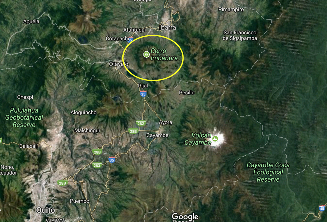
Satellite image of Cerro Imbabura,
Otavalo, Cayambe and surrounding area with Quito in the far bottom left


No comments:
Post a Comment