skip to main |
skip to sidebar
Answering the Great Lakes Theorist – Part VIII
Continuing with a reader named Guy and his lengthy critical
comments:
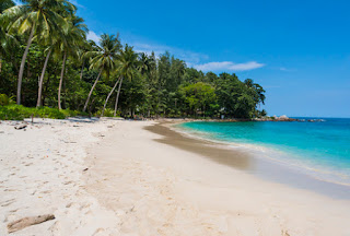
Reader: “There are no BEACHES or PLAINS where they are
supposed to be. The land terrain does not match with "hills" and
forests. Instead there are gigantic mountains, volcanoes, etc.”
Response: First, only one beach is mentioned in the entire
Book of Mormon and that is east of Bountiful when Amalickiah pitched his tents
in the borders on the beach by the seashore” (Alma 51:32); secondly, only four
plains are mentioned: Plains of Heshlon (Ether 13:28); Agosh (Ether 14:15-16); Plains
between the two cities Mulek and Bountiful (Alma 52:20); Plans of Nephihah
(Alma 62:18). None of these plains or the one beach are mentioned in such a way
as to know where they specifically were located (wxcept where a landing would be). It would be difficult for
anyone to know on a current map where a beach might have been. It is a silly
and worthless comment to make in defense of a Land of Promise model, especially
when the single beach would have been in the east of Bountiful where no beaches exist in the Great Lakes model, for
there are no beaches along the finger lakes, though there are seashores. And as
for the plains, we have no idea where any plain was located in the Land
Northward, for where was Hershon and Agosh? And where is a plain between
Bountiful and Mulek in the Great Lakes model, or near Nephihah in the Great
Lakes model?

As for Andean, South America, there are beaches all along
the West coastal plain where one would expect them to be. There are no beaches
in the east because there is no longer a Sea East with the rising of the
continent east of the Andes. Second, for a Great Lakes theorist to raise a
question of what is missing from a South American model is really quite
disingenuous since there are no mountains in the Great Lakes nor even hills to
speak of, yet in Helaman 14:23 and again in 3 Nephi there is mentioned of
mountains and hills. Take, as an example, besides Samuel the Lamanite talking
about mountains, “whose height is great,” what about the Gaddianton Robbers who
“began to come down and to sally forth from the hills, and
out of the mountains” (3 Nephi 4:1), or the “hills” that covered sunken cities
(3 Nephi 9:8), or where is the “great mountain” that covered the city of Moronihah?
(3 Nephi 8:10), or the mountains in which the Robbers dwelt? (3 Nephi 1:27),
and where are the mountains in which the Nephites “did drive them back out of their lands into the mountains”?
(3 Nephi 2:17), or where are the mountains referred to when “the people said
unto Giddgiddoni: Pray unto the Lord, and let us go up upon the mountains” (3
Nephi 3:20)?

These mountains are
also mentioned seven times in Helaman 11:25,28,31); and hill or hills are
mentioned nine times in Alma 1:15; 2:15,17; 26:29; 32:4; 43:31,34,35). Yet, I
have driven all over the state of New York wherein the Great Lakes theorists
claim would be the Land of Promise, from the hill Cumorah in the northeast, to
the finger lakes in the east, to Lake Erie in the west and down to Pennsylvania
in the south, and there are no hills or mountains at all.
How many mentions of
mountains and hills do we need to find in the scriptural record before the
Great Lakes theorists will actually sit up and take notice and say honestly to himself, “Hey, there are no
hills and mountains in western New York!”
Reader: “Plagerism.
Why is that all the source materials DowDell consulted, the one book that is of
the precise same model as "his" own is never mentioned: "The
Book and The Map" by Venice Priddis, Bookcraft, 1975"?

Response: If you would have asked me, Guy, I would have told
you as I have answered before about Venice Priddis’ book. Until this year, I
had never read nor heard of her book or knew anything about it other than seen the
title on the internet—the Book and the
Map, which had never drawn a connection to South America in my mind—as part
of a long list of theories about the Book of Mormon. When I wrote the four
books of this series and for 5 plus years of the blog, I did not know who she
was. I knew who Art Kocherhans was (a close friend), and acknowledge his work
in my book and elsewhere in this blog. Since reading her book, I have mentioned
her quite a lot in this blog, which you would have known had you read anything
about what we have written and posted over the past six years.
As a matter of fact,
her book was recommended to us by one of our readers last year. When I tracked
it down and ordered it (I thought Venice was a man), I read it in November of
last year and mentioned her name and work in my blog for the first time on December 18, 2015, in an article
about “America is the Land of Promise—But
Where is America – Part III.” We referenced again
this year on February 5 “More Comments from Readers” and then in an article in
March 18 wrote a serious defense of her work in which I mentioned her name
fourteen (14) times throughout the article, which was written in her defense of
John L. Sorenson’s unmitigated attack on her work, in which he wrote: “The
Book and the Map, ‘New Insights into Book of Mormon Geography,’ by
Venice Priddis (Salt Lake City: Bookcraft, 1975, $3.95, pp.), differs in focus
from the volumes discussed above, but the quality of scholarship is similar”
in which he tore into Priddis’ work, among others, as not being scholarly, etc. Mentioned her again 4
times in March 19 blog, 1 more time on March 24 blog.
You may not know that
Venice Martin Priddis (she pronounced her name Preddes) lived in Pleasant
Grove, Utah, and died there on March 31, 2009, her pioneer work completely
marginalized by John L. Sorernson who criticized it extensively. Born in
Wyoming, she grew up on a dairy farm in Draper, Utah, where two of my sons
lived far more recently. But in all of that, I never heard of her until
mid-last year. You also might not know that her book was based almost entirely
“on Joseph Smith’s comment that the Nephites landed at 30 degrees latitude
south (in Chile) and places the narrow neck of land on the western coast above
that.”

Reader: [As part of
his attack about plagerism, he quotes a paragraph out of Venice Priddis’ book]
“Sample. Since the
hill [cerro Imbabura - their hill Cumorah] is considered sacred, the name given
to certain sections of it may represent events which have taken place on its
slopes. I note that, on a detailed map of the cerro Imbabura which I have in my
possession, such names as Batallon (Battalion) Imbabura, Compania (Company)
Imbabura, and Zapallo Loma (in Ecuadorian, sad person hill), are given to parts
of the hill. It is a very interesting hill indeed. (p. 57)
Response: That is taken from a Swiss journalist, Peter Schmid, whose writing is colorful though he bounces around a lot in Beggars on Golden Stools, translated by Mervyn Savill (Prsaeger, New Yorik, 1956, pp173-1755). Perhaps it might be of interest that I had a collection of over 1000 maps, many of ancient work, until I sold them a few years ago, many of which were of Peru, the Andes, and the area of South America.
I might just add another very obvious and glaring problem
for the Great Lakes theorist that is never
mentioned by anyone of them I have ever seen and that is how the aged Lehi got
to the Sea West, their northern Lake Erie, where it is said by Mormon that they
landed and was labeled by him the Land of First Inheritance: “on the west in the land of Nephi, in
the place of their fathers' first inheritance, and thus bordering along by the
seashore” (Alma 22:28). Nephi’s ship could not
have reached the lake by any means available through the United States, for the
Mississippi and other inland seas did not reach lake Erie before the Corps of
Engineers created openings, and the main rivers were too shallow for deep sea
ocean vessels to pass before the Corps of Engineers dredged them out. Nor could
they have passed around Montreal’s shallows and the Lachine Rapids before the
Canadian River (St. Lawrence Seaway) engineers dug another channel around
Montreal, and then later created locks to bypass the Long Sault Rapids west of
Cornwall nearer Lake Ontario. Granted it is a minor point to the Great Lakes
theorist, but would have been a huge issue to any ship trying to reach the Great
Lakes prior to the 19th century.

It might also be
noted that the height of Lake Ontario is considerably higher than the St Lawrence River, and takes a series of seven locks
(six Canadian locks: St. Lambert, Core ste. Catherine, Lower Beauharnois, Upper
Beauharnois, and the Iroquois locks; and two American (Snell and Eisenhower
locks) between Montreal and Lake Ontario to raise the level of water for ocean
shipping to rise up to height of Lake Ontario. Then to get from Lake Ontario to
Lake Erie is the Welland Canal, which is 27 miles long and includes 8 locks of
its own between Port Weller and Port Colborne to elevate shipping 326 feet to
Lake Erie, which allows shipping to ascend and descend the Niagara Escarpment
and bypass Niagara Falls since its construction in 1830. It may be a minor point, but raising an ocean-going vessel 325 feet from Ontario to Erie, the equivalent of a 32-story building, is something that cannot be done in nature before man invented river locks.


No comments:
Post a Comment