
First of all, it is poor scholarship to think that the topography, contour and territory of the Land of Promise basically looks the same way today as it did 2600 years ago at the time Lehi landed. In addition, we need to understand that Lehi landed on an island—Jacob makes that quite clear (2 Nephi 10:20), and this island was upon the very same sea over which they sailed from Bountiful, for Jacob said, “we have been led to a better land, for the Lord has made the sea our path, and we are upon an isle of the sea.” Thus, this island was in the middle of the ocean over which the Lehi colony traveled in the ship Nephi built.
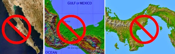
Of course, since Jacob's description and Nephi's verification by writing it down, tells us the Land of Promise was an island, you can see why no Mesoamerican, Great Lakes, Heartland, Baja, Malay, Central America, etc., Theorist quotes 2 Nephi 10:20 since it completely eliminates their model, research, and position. Yet, Jacob made it very clear they were on an island and repeats it twice to calm the fears of the Nephites that they had been forgotten.
In addition, in 1828, the words “peninsula” and “isthmus” were well known, and were not chosen by Joseph Smith as the correct translation of Mormon’s wordage (peninsula, byt the way, is from paenînsula
-->, meaning "almost-island"). To this, we should add that the Spirit acknowledge that “isle” (island) was the correct translation. Continuing, this Land of Promise island was located on the very same sea over which the Lehi Colony sailed, “for the Lord has made the sea our path, and we are upon an isle of the sea,” and their landing was located on the west coastal shore of that island as Mormon stated:
“…on the west in the land of Nephi, in the place of their fathers' first
inheritance, and thus bordering along by the seashore (Alma 22:28).
That they were on an island is verified by Helaman’s comment “And it came to pass that they did multiply and spread, and did go forth from the land southward to the land northward, and did spread insomuch that they began to cover the face of the whole earth, from the sea south to the sea north, from the sea west to the sea east” (Helaman 3:8). Even Mormon, writing about the Land Southward made the statement that the Land of Zarahemla and the Land of Nephi were nearly surrounded by water except for a small neck of land (Alma 22:32). This neck of land, of course, was connected to the Land Northward, which also was surrounded by water, though Mormon was not writing about that area at this time—a west sea (Ether 14:12; Mormon 4:3) and east sea (Ether 9:3) are mentioned, and a very large sea to the north is mentioned by way of the waters of Ripliancum, which translated, is “large, or to exceed all” (Ether 15:8).
In addition, we find that the Nephites were not only involved in shipping enterprises, but were also a ship-building nation (Helaman 3:14), suggesting a lot of access to the sea, with numerous ports throughout the country to make shipping a profitable business. And we are not talking about canoes, even large ones, or rafts, etc., for the Lord told Nephi how to work the timbers (1 Nephi 18:1), and how to build a ship “in the manner that I will show thee” (1 Nephi 17:8), and that manner was not after the manner that men built ships (1 Nephi 18:2). It was a ship designed to take the Lehi colony across the ocean (1 Nephi 17:8).
It seems only obvious that this ship building knowledge would have been passed on after they landed, for 550 years later Hagoth is building “exceedingly large ships” in his shipyard near the narrow neck of land and launching them into the West Sea (Alma 63:5). In addition, the Nephites were shipping provisions to the Land Northward (Alma 63:10), and also timber (Helaman 3:10). Obviously, these ships were of huge dimensions and capable of carrying men, women and children emigrants, as well as provisions and supplies for emigrants to start a new life in another land (Alma 63:6).
Thus the Land of Promise was so located upon the ocean as to have seaports both in the Land Southward and in the Land Northward where “exceedingly large ships” could be built and carried provisions and timber to far off ports.
 The American Great Plains—flat as a pancake for hundreds and hundreds
of miles
The American Great Plains—flat as a pancake for hundreds and hundreds
of miles
This Land of Promise was not flat, like the Great Plains of the U.S. covering one-third of America. It had mountains, but not so many for there were prairies as well. Nephi, having a vision of the Land of Promise at the time of the crucifixion and just before the “Lamb of God descended out of heaven” saw “mountains tumbling into pieces, and the plains of the earth were broken up” (1 Nephi 12:4).
 Samuel the Lamanite said many mountains would be laid low (Helaman
14:23) and Nephi said these mountains would tumble into pieces (1 Nephi 12:4)
Samuel the Lamanite said many mountains would be laid low (Helaman
14:23) and Nephi said these mountains would tumble into pieces (1 Nephi 12:4)
These existing mountains, however, were not very high, for when Samuel the Lamanite foresaw the destruction he said, “there shall be great tempests, and there shall be many mountains laid low, like unto a valley, and there shall be many places which are now called valleys which shall become mountains, whose height is great” (Helaman 14:23, emphasis mine). Since he made a distinction between those mountains that existed in the Land of Promise with those new ones that would rise up out of valleys to a height “which was great,” we can understand that these new mountains would be much taller than those the Nephites had known, otherwise his comment makes little sense.
 Left to Right: West: Mt. Elbert, highest mountain in Colorado [14440
feet], East: White Mountain in New Hampshire [6288 feet]; Great Lakes: Mount
Marcy, New York [5343 feet]; South America: Mt. Aconcagua, Andes [22864 feet). By comparison, the latter mountain has a height which is great!
Left to Right: West: Mt. Elbert, highest mountain in Colorado [14440
feet], East: White Mountain in New Hampshire [6288 feet]; Great Lakes: Mount
Marcy, New York [5343 feet]; South America: Mt. Aconcagua, Andes [22864 feet). By comparison, the latter mountain has a height which is great!
We can also understand that the Land of Promise was an elongated island, longer north to south than it was wide, east to west, and that the east coast was conducive to locating cities with large populations living there (Alma 50:13-15). We also know that the Land of Zarahemla was at a lower elevation than the Land of Nephi (and the Land of Shilom), the latter being built in a high plateau or altiplano with higher hills around it (Mosiah 7:5-7).
It should also be noted that though Mormon does not seem to have any difficulty in finding his way around the changed or altered Land of Promise after this destruction, his entire life was lived long after this destruction and change. He was born in 305 A.D., exactly 271 years after the destruction and change listed in 3 Nephi 8. By comparison, 271 years ago was 33 years before Father Silvestre Vèlez de Escalante, the first European explorer in Utah, arrived; 81 years before John Chugg, the first U.S. citizen to see Salt Lake (with Jim Bridger the following year); and 100 years before John C. Fremont and Kit Carson surveyed the Great Salt Lake valley just before the Mormons arrived.
 Salt Lake City in 1850, 164 years ago. Did people arriving then have any difficulty in understanding the Salt Lake Valley had been a desert with few trees and little growth before their arrival?
The point is, Mormon would not have known anything about the pre-34 A.D. land except for what he read, and what did exist (the changes brought about in 3 Nephi 8) were so old, no one alive would have known of the ancient topography, nor even their grandparents, so the idea that many Theorists promote, that Mormon seems not bothered by the changes, would have no meaning whatsoever, and obviously not an indicator that those changes were minimal.
The fact, it may be significant that he does not mention certain features in his own writing that are mentioned in the writings of others that Mormon abridged, might suggest that those features no longer existed in Mormon’s time, such as the Sea East and the narrow neck of land. Other features, like the narrow passage and the West Sea are mentioned both in earlier writings and in Mormon’s book, or writing.
(See the next and final post, “Changing Land of Promise—Part XVII”)
That they were on an island is verified by Helaman’s comment “And it came to pass that they did multiply and spread, and did go forth from the land southward to the land northward, and did spread insomuch that they began to cover the face of the whole earth, from the sea south to the sea north, from the sea west to the sea east” (Helaman 3:8). Even Mormon, writing about the Land Southward made the statement that the Land of Zarahemla and the Land of Nephi were nearly surrounded by water except for a small neck of land (Alma 22:32). This neck of land, of course, was connected to the Land Northward, which also was surrounded by water, though Mormon was not writing about that area at this time—a west sea (Ether 14:12; Mormon 4:3) and east sea (Ether 9:3) are mentioned, and a very large sea to the north is mentioned by way of the waters of Ripliancum, which translated, is “large, or to exceed all” (Ether 15:8).
In addition, we find that the Nephites were not only involved in shipping enterprises, but were also a ship-building nation (Helaman 3:14), suggesting a lot of access to the sea, with numerous ports throughout the country to make shipping a profitable business. And we are not talking about canoes, even large ones, or rafts, etc., for the Lord told Nephi how to work the timbers (1 Nephi 18:1), and how to build a ship “in the manner that I will show thee” (1 Nephi 17:8), and that manner was not after the manner that men built ships (1 Nephi 18:2). It was a ship designed to take the Lehi colony across the ocean (1 Nephi 17:8).
It seems only obvious that this ship building knowledge would have been passed on after they landed, for 550 years later Hagoth is building “exceedingly large ships” in his shipyard near the narrow neck of land and launching them into the West Sea (Alma 63:5). In addition, the Nephites were shipping provisions to the Land Northward (Alma 63:10), and also timber (Helaman 3:10). Obviously, these ships were of huge dimensions and capable of carrying men, women and children emigrants, as well as provisions and supplies for emigrants to start a new life in another land (Alma 63:6).
Thus the Land of Promise was so located upon the ocean as to have seaports both in the Land Southward and in the Land Northward where “exceedingly large ships” could be built and carried provisions and timber to far off ports.
This Land of Promise was not flat, like the Great Plains of the U.S. covering one-third of America. It had mountains, but not so many for there were prairies as well. Nephi, having a vision of the Land of Promise at the time of the crucifixion and just before the “Lamb of God descended out of heaven” saw “mountains tumbling into pieces, and the plains of the earth were broken up” (1 Nephi 12:4).
These existing mountains, however, were not very high, for when Samuel the Lamanite foresaw the destruction he said, “there shall be great tempests, and there shall be many mountains laid low, like unto a valley, and there shall be many places which are now called valleys which shall become mountains, whose height is great” (Helaman 14:23, emphasis mine). Since he made a distinction between those mountains that existed in the Land of Promise with those new ones that would rise up out of valleys to a height “which was great,” we can understand that these new mountains would be much taller than those the Nephites had known, otherwise his comment makes little sense.
We can also understand that the Land of Promise was an elongated island, longer north to south than it was wide, east to west, and that the east coast was conducive to locating cities with large populations living there (Alma 50:13-15). We also know that the Land of Zarahemla was at a lower elevation than the Land of Nephi (and the Land of Shilom), the latter being built in a high plateau or altiplano with higher hills around it (Mosiah 7:5-7).
It should also be noted that though Mormon does not seem to have any difficulty in finding his way around the changed or altered Land of Promise after this destruction, his entire life was lived long after this destruction and change. He was born in 305 A.D., exactly 271 years after the destruction and change listed in 3 Nephi 8. By comparison, 271 years ago was 33 years before Father Silvestre Vèlez de Escalante, the first European explorer in Utah, arrived; 81 years before John Chugg, the first U.S. citizen to see Salt Lake (with Jim Bridger the following year); and 100 years before John C. Fremont and Kit Carson surveyed the Great Salt Lake valley just before the Mormons arrived.
The point is, Mormon would not have known anything about the pre-34 A.D. land except for what he read, and what did exist (the changes brought about in 3 Nephi 8) were so old, no one alive would have known of the ancient topography, nor even their grandparents, so the idea that many Theorists promote, that Mormon seems not bothered by the changes, would have no meaning whatsoever, and obviously not an indicator that those changes were minimal.
The fact, it may be significant that he does not mention certain features in his own writing that are mentioned in the writings of others that Mormon abridged, might suggest that those features no longer existed in Mormon’s time, such as the Sea East and the narrow neck of land. Other features, like the narrow passage and the West Sea are mentioned both in earlier writings and in Mormon’s book, or writing.
(See the next and final post, “Changing Land of Promise—Part XVII”)


You said "the words “peninsula” and “isthmus” were well known, and were not chosen by Joseph Smith as the correct translation of Mormon’s wordage"
ReplyDeleteIn the paragraph previous to this, you properly attribute the term "isle" to Jacob rather than Mormon. This is an important distinction. Mormon never describes the land as an isle.
As mentioned in another article(http://nephicode.blogspot.com/2014/10/an-island-that-is-island-is-island.html), at the time that Jacob tells us "and we are upon an isle of the sea", we have no reason to believe that he, or anyone else from Lehi's party, had explored northward far enough to pass Zarahemla, to pass through the Jaredite lands, to pass by the "many rivers and large bodies of water" that were an "exceedingly great distance" in the land northward to find find out if the land was or was not eventually connected to a continent.
Additionally, as you pointed out in the other article I mentioned above, there is an alternate meaning for 'island' that you find appropriate that fits an isolated area of a peninsula quite well. You quoted the secondary definition “something resembling an island, especially in being isolated or having little or no direct communication with others.”
The best translation for Jacob's term turned out to be 'isle', and that term makes a lot of sense for him to say if he was living in the cape region of the Baja peninsula.