Monday, February 28, 2011

Land Filled from Sea to Sea.

The Land of Promise, both the Land Northward and the Land Southward, was described as filled with Lehi’s descendants on more than one occasion. In fact, the idea of people filling up the land is a constant thread through the scriptural record.

The Jaredites, after a war that left only a handful of people in the land (Ether 9:12), multiplied until “the people had spread again over all the face of the land” (Ether 9:26). Later, “the people began again to spread over all the face of the land. (Ether 10:4), and still later, “the whole face of the land northward was covered with inhabitants” (Ether 10:21). Helaman tells us that when the Nephites went into the Land Northward, “they did multiply and spread, and did go forth from the land southward to the land northward, and did spread insomuch that they began to cover the face of the whole earth, from the sea south to the sea north, from the sea west to the sea east” (Helaman 3:8).

Thus, the entire Land of Promise, from the south where Lehi landed, to the north, where the waters of Ripliancum flowed, the land is described as filled with people. We might even today say that the State of Utah is filled with people, but California is more filled with people, and that the entire United States, from border to border and sea to sea, is filled with people.

However, some have interpreted the land of Promise “filled with people” to mean that the entire land was full of people, but this is not the meaning of the phrase. This statement merely means that people were found in every quarter of the land and that there was no significant place where people would not be found. It does not mean the land was crowded with people like, say, New York City is crowded with people.

After the Jaredires were wiped out to the man, their bones lay on the ground because the battles were so swift and fierce, no one had a chance to stop and bury the dead (Ether 14:22) during the long wars that took place. And after the wars, no one remained alive to go back and bury the bodies. Ether wrote that “the whole face of the land was covered with the bodies of the dead” (Ether 14:21). But this does not mean that every square foot of space had a dead body on it, any more than the smell of the dead “bodies of both men, women, and children strewed upon the face of the land, to become a prey to the worms of the flesh. And the scent thereof went forth upon the face of the land, even upon all the face of the land; wherefore the people became troubled by day and by night, because of the scent thereof” (Ether 14:22-23) was everywhere in the land—though it would have covered much of it, particularly where the people were that were left upon the land after so many had died.

The point is, theorists who want to limit the land space of the Land Northward, cite these instances to claim that if “dead bodies were strewn all over the land, it must have been a small area,” and the same with the smell.

But the Land Northward was not small. It was sufficiently large, though smaller than the Land Southward, to house somewhere between 20 and 25 million at one time, based on the numbers Coriantumr cites of the dead in his own army: “there had been slain two millions of mighty men, and also their wives and their children” (Ether 15:1-2). Two million with close to a similar number of wives, and at least two children per couple for a total of 8 million in one army, and probably an equal number in Shiz’ army for 16million. If there were more than two children per family, and the Jaredites had large families, then the numbers could have been upwards of 20 to 25 million. And these numbers were before the events of gathering everyone in the land to their armies for the final battles (Ether 15:14-15,31)

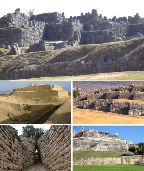
Thus, to try and limit the size of the Land Northward to conform to a predetermined model is not justified. In Mesoamerica, Guatemala, as their Land Southward, is only 42,000 square miles—about 42% of the size of Nevada, and half the size of Utah. Yet, the populations of both sparsely populated states is just under 5.5 million. If you include the Yucatan, which the theorists’ do in the Land Southward, then there is another 67,000 square miles for a total of 109,000 square miles—which is the size of either Utah or Nevada.

It also might be stated that 25 million in the Land Northward would be the equivalent of both London and Beijing populations, and would be the 47th largest country in today’s world—larger than Australia, North Korea, or Taiwan, about the same size as all of Scandinavia, including Denmark, combined, and larger than Guatemala and Greece combined, and about the size of Guatemala, Honduras and El Salvador combined.

The point is, 25-million people would take up a considerable land space and certainly does not lend itself to the idea of a limited area as Mesoamerican and Great Lakes theorists try to make it.

Sunday, February 27, 2011

Were There Really Four Seas Surrounding the Land of Promise?

The Land Southward was divided by a "narrow strip of wilderness" that ran from the "sea east" to the "sea west" (Alma 22:27). Nephites occupied the land to the north of this wilderness, and the Lamanites, occupied the land to the south of this wilderness. Sidon, the only river mentioned by name, ran northward between eastern and western wildernesses from headwaters in the narrow strip of wilderness (Alma 22:29). The Sidon probably emptied into the east sea—based on the description of the east wilderness as a rather wide, coastal zone—but its mouth is nowhere specified.

Book of Mormon lands were longer from north to south than from east to west. They consisted of two land masses connecting a “narrow neck of land” flanked by an "east sea" and a "west sea" (Alma 22:27, 32). The land north of the narrow neck was known as the Land Northward and that to the south was the Land Southward (Alma 22:32). The Jaredites occupied the Land Northward and spent their entire time there, never coming south of the Narrow Neck of Land except to hunt for wild game (Omni 1:22; Ether 10:21). It is also probable that the portion of the land northward occupied by the Jaredites was smaller than the Nephite-Lamanite land southward.

It is also probable that the Nephites were not aware of the narrow neck of land, or that there was a Land Northward, until sometime after 200 B.C. (following Mosiah's arrival in Zarahemla). Up to this point, and probably for some years afterward, the Nephites were only aware of their Land Southward and of its division into two areas, the Land North and the Land South, and that Lehi was led into the Land South, where he landed, and the people of Zarahemla were in the Land North, which was where Mulek landed (Helaman 6:10, Omni 1:16).

The first mention of the land northward is about 121 B.C. when it was explored by Limhi's search party (Mosiah 8:8). It seems obvious that no Nephite had been to the land northward before this since the land of bones and ruined buildings had not previously been mentioned. The next reference is about 90 B.C. and this was a commentary by the abridger Mormon writing about 340 AD (Alma 22:31-2). Alma, writing about 55 B.C., describes a massive movement northward by ship (Alma 63:5-7), and two years later, by land (Alma 63:9). About eight years later, in 46 B.C., Helaman describes a massive movement of “an exceeding great many who departed out of the land of Zarahemla” and went into the Land Northward “to inherit the land” (Helaman 3:3). This latter group of people went far northward, coming “to large bodies of water and many rivers” (Helaman 3:4), and “spread forth into all parts of the land” (Helaman 3:5) and they multiplied and spread out, and “did go forth from the land southward to the land northward, and did spread insomuch that they began to cover the face of the whole earth, from the sea south to the sea north, from the sea west to the sea east” (Helaman 3:8).

According to Helaman, writing at the time of this movement and spreading out of the people in both the Land Southward and the Land Northward, he makes certain we would understand that the Land of Promise was inhabited from one end to the other, and from one sea to another. In naming all four seas that surrounded the island Jacob described (2 Nephi 10:20), Helaman gives us a clear picture of this ancient land in his day, as does Mormon later describing the period 200 years after the coming of Christ (4 Nephi 1:23).

Mormon, who was born in the Land Northward about 350 years after Helaman’s time and traveled into the Land of Zarahemla (Mormon 1:6) writes about “the whole face of the land had become covered with buildings, and the people were as numerous almost, as it were the sand of the sea” (Mormon 1:7). It was Mormon, injecting his words into Alma’s description of the land that said, “and thus the land of Nephi and the land of Zarahemla were nearly surrounded by water, there being a small neck of land between the land northward and the land southward (Alma 22:32).

This, then, shows that there was a Sea completely surrounding the entire Land Southward that reached the narrow neck of land, which ran from the West Sea (Alma 63:5), to the East Sea (Alma 50:34). This surrounding Sea also extended northward around the entire Land Northward (Helaman 3:8). Thus, the Land of Promise had four seas that surrounded the land, making it an island as Jacob said.

Saturday, February 26, 2011

The Oceanic Winds and Currents of Antiquity

Man first began to acquire knowledge of the waves and currents of the seas and oceans in pre-historic times. Observations on tides are recorded by Aristotle and Strabo, and the earliest exploration of the oceans was primarily for cartography and mainly limited to its surfaces and of the creatures that fishermen brought up in nets, though depth soundings by lead line were taken. And when Louis Antoine de Bougainville, who voyaged between 1766 and 1769, and James Cook, who voyaged from 1768 to 1779, carried out their explorations in the South Pacific, information on the oceans themselves formed part of the reports.

James Rennell wrote the first scientific textbooks about currents in the Atlantic and Indian oceans during the late 18th and at the beginning of 19th century. Sir James Clark Ross took the first modern sounding in deep sea in 1840, and Charles Darwin published a paper on reefs and the formation of atolls as a result of the second voyage of HMS Beagle in 1831-6, with Fitzroy publishing a report in four volumes of the three voyages of the Beagle.

The steep slope beyond the continental shelves was not discovered until 1849. Matthew Fontaine Maury's “Physical Geography of the Sea,” 1855 was the first textbook of oceanography. The first successful laying of transatlantic telegraph cable in August 1858 confirmed the presence of an underwater "telegraphic plateau" mid-ocean ridge.

In all, the knowledge of the oceans and their currents, and how the winds affect these currents, is relatively new. However, the basic understanding that a weather sailing ship “driven forth before the wind” went where the winds and currents took it, was known anciently. This is because there are a number of ocean currents found around the Earth. A current is like a vast river within the ocean, flowing from one place to another. These currents are caused by differences in temperature, differences in salinity, and by wind. Currents are responsible for a vast amount of movement of the water found in the Earth’s oceans.

Generally, these currents do not change within the Atlantic, Pacific and Indian Oceans, and their direction, which is constant, is driven by the Earth’s rotation and affected by the Coriolis Effect, which causes currents to bend downhill toward the poles. For this reason, currents in the southern hemisphere rotate in counter-clockwise gyres, and currents in the northern hemisphere rotate in clockwise gyres. Understanding this is what allowed Columbus to drop down to the Canary Islands off the coast of Africa and then turn west into the gyre that took him to the Caribbean Islands in the Western Hemisphere. For this same reason, Europeans were unable to sail west into the Atlantic Ocean from northern latitudes because the clockwise gyre brought the currents against them. For this reason, it took the small Viking ships using oars to move westward along the coastal waters of Iceland and Greenland to reach Canada—but stopped any large scale sailing westward into those waters.

Within the Arabian Sea, currents change semi-annually, between blowing inland and blowing out to sea. The Trade Winds blowing north and west off the coast of Australia, and mostly westward through Indonesia, do not change, but are constant all year long. With currents moving along the northern reaches of the Arabian Sea in a westward direction, shipping did not move eastward from Arabia toward India and Indonesia without enormous effort and very lengthy voyages, which entailed stopping frequently along the shores. For this reason, the Portuguese found it almost impossible to sail around Africa and north into the Arabian Sea and then east toward China. Once they discovered the Southern Ocean currents (Prevailing Westerlies and West Wind Drift) moving swiftly eastward across the southern reaches of the Indian Ocean, they were able to make their journey looping wide around southern Africa and then toward Australia, catching the Trade Winds northward and to China and Indonesia.

While Mesoamerican and most other theorists like to draw lines across a map and claim the Lehi Colony sailed eastward from Arabia, through Indonesia, and then across the Pacific Ocean to Central America, the currents described above would not have allowed any sailing ship in 600 B.C., especially a weather ship “driven forth before the wind” to have made such a journey. The only currents that would have taken a ship from the southern coast of Arabia to the Western Hemisphere would have taken a ship south from Arabia, then southeast through the Indian Ocean, and then eastward in the currents of the Southern Ocean. No other way using currents and winds could a ship “driven forth before the winds” have left the southern Arabian Peninsula and sailed to the Western Hemisphere.

Friday, February 25, 2011

Columbus’ Divine Mission

In the 15th century, “the Indies” was a loose term referring to India, China, and Japan, as well as to other far eastern places. Europe had built up a great trade with these areas in oriental rugs, flowered silks, gems, spices, porcelains, damasks, dyes, drugs, perfumes, and precious woods. These commodities had been brought laboriously by overland caravans to the Persian Gulf and the Black Sea, or had crept along the burning sands of Arabia to the Red Sea.

At the height of this trade, the Osmanli Turks blocked the path of these caravans in an effort to drive the Christians out of Asia. The luxury-hungry upper class Europeans were therefore under the necessity of finding a new way to the Indies if they were to continue to enjoy the trade with those distant countries. This, then, led to the explorations by Sea, both around South Africa and westward over the Atlantic.

Columbus before the king and queen of Spain seeking support for "his enterprise"

During these early years, Cristoforo Colombo, as he was known in Genoa, was well versed in the navigational progress of his day and had been convinced by his studies that he could reach the Indies by sailing westward across the Atlantic. It was at this time that he developed what he called “his enterprise.” While people like David S. Muzzey of Columbia University, in the first sentence he wrote in his “American History,” that “the discovery of America was an accident,” Columbus felt quite differently. As he wrote of himself:

“From my first youth onward, I was a seaman and have so continued until this day. Wherever on the earth a ship has been, I have been. I have spoken and treated with learned men, priests, and laymen, Latins and Greeks, Jews and Moors, and with many men of other faiths. The Lord was well disposed to my desire, and He bestowed upon me courage and understanding: knowledge of seafraring He gave me in abundance, of astrology as much as was needed, and of geometry and astronomy likewise. Further, He gave me joy of cunning in drawing maps and thereon cities, mountains, rivers, islands, and harbours, each one in its pace. I have seen and truly I have studied all books—cosmosgraphies, histories, chronicles, and philosophies, and other arts, for which our Lord unlocked my mind, sent me upon the sea, and gave me fire for the deed. Those who heard of my emprise called it foolish, mocked me, and laughed. But who can doubt but that the Holy Ghost inspired me?”

It was during this time that the study of geography and the science of navigation flourished, and hundreds of “portolani” or sailing charts were drawn by Italian and Portuguese mariners. Six new editions of the “Geography” were published between 1472 and 1492, and the compass and the astrolabe were perfected. Ships were designed to sail close to the wind and to stand the buffeting of the high ocean waves. Before the end of the century, Portuguese sailors had pushed nearly a thousand miles westward into the unchartered Atlantic, and were creeping mile by mile down the western coast of Africa.

Columbus studied all these charts, drawings, captain’s logs, and other material regarding the geography of the world as it was becoming known in his day. As a guide for his planned voyage, he had a chart made for the king of Portugal in 1474, by the Florentine astronomer Toscanelli, which he used to demonstrate that the Indies could be reached by sailing westward. He went before the king with knowledge and presentation, and also with enthusiasm born of what he frequently described as inspiration. He truly felt that he was guided by the Holy Ghost.

On August 2, 1492, the entire crew of forty men went to prayers in a little church near the docks; the next morning they set out on their voyage over what was called “The Sea of Gloom.” Many of the superstitious sailors still believed the world was flat and that there was a real possibility that if they kept going to the horizon they might fall of the edge. It is likely that Columbus was the only person on the three ships that set out on “his enterprise” that believed the Holy Ghost was behind this endeavor. Later he would write to King Ferdinand of Spain that “I came to your Majesty as the Emissary of the Holy Trinity.” He always insisted that he should be regarded as one inspired, and when he presented himself as inspired by the Holy Ghost, he was convinced from the bottom of his heart that he was speaking the truth.

Columbus' first voyage reached the area of the Caribbean. In none of his voyages did he ever set foot on North America, but did reach southward, even to South America

"And I looked and beheld a man among the Gentiles, who was separated from the seed of my brethren by the many waters, and I beheld the Spirit of God, that it came down and wrought upon the man; and he went forth upon the many waters, even unto the seed of my brethren, who were in the promised land” (1 Nephi 13:12).

Thursday, February 24, 2011

City of Bountiful in the Land of Bountiful, Part IV

Continuing with the last three posts regarding the possible location of the city of Bountiful in the northern Peruvian highlands, a discussion of the capital parts of the Peruvian agricultural lands has been shown. There is also the accompanying irrigation capabilities of these ancients who irrigated these northern highlands by bringing water down from higher watersheds as well as across from the Pacific to the Atlantic draining basins.

The area of Cumbe Mayo is located about 12 miles southwest of Cajamarca at an elevation of approximately 11,000 feet. The location is best known for the ruins of an ancient aqueduct stretching approximately five miles in length and thought to have been constructed around 1500 B.C. The name Cumbe Mayo may be Quechua “kumpi mayu,” meaning “well-made water channel.” There are a number of complex and unusual petroglyphs on the aqueduct and surrounding caverns.

In the area of these northern highlands sits the city of Cajamarca, its history covered in the last post. Adjacent to Cajamarca proper is the temple of Kuntur Wasi, a major site being excavated by Japanese archaeologists. This temple, shown in the last post, occupied a very significant area overlooking the surrounding valley and was decorated with some of the oldest samples of Cajamarca goldsmithing considered to be as old as the second millennium B.C. These ancient Peruvians built the imposing stairways and stone walls of a pyramidal structure with a square platform and temples on its top.

From around the 7th to the 2nd centuries BC, representatives of the Cupisnique coastal culture settled in the area, with ceramic ware, goldsmith work, sculpture and architecture that of the Chavin culture. Nearby is "Las Ventanillas de Otuzco" (the Little Windows of Otuzco), an impressive collection of funerary niches carved into the rock wall of a mountain; some of the orifices are mere niches, while others connect with a corridor leading to the heart of the mountain, where there is a room with more niches carved into the walls—other similar groupings exist in Bambamarca, Quilcate, San Cristobal, Cerro Yanguil and Combayo—their remains of ceramics indicate that they belonged to the Cajamarca culture.

Researches believe that due to their similarity there is a connection between the unique and particularly beautiful ceramics of Cajamarca and those of Central America, and especially those of Costa Rica and Nicaragua.

Should this site prove to be the city of Bountiful within the Land of Bountiful of the Land of Promise, it matches several facets of Mormon’s descriptions. Cajamarca is at the end of a long series of valleys stretching from south of Lima (Pachacamac) all the way north to the Bay of Guayaquil (narrow neck of land), with a corridor toward the west that slopes down to the ocean. There is a magnificent temple site in an imposing area, and numerous advantages to the locale, such as excellent soils for agriculture, elevated ground to the east where the seashore once was located, extension to the west to the seashore, just south of where the land narrows considerably, a very ancient inhabitation, and numerous settlements in the area that supported a large population in B.C. and early A.D. times. It has always been an important city and region throughout the history of the Andean area, extensive gold and silver work has been found in the area, and there is a natural division line to the east which would have contained a separate land such as Mulek.

The plain to the east of Cajamarca. Like the Plain between Mulek and the city of Bountiful, there is a low hill (arrow) beyond which would have been the high ground leading down to the east seashore that Teamcum descended

The entire area has been occupied since the first millennium B.C. and considered one of the most sacred areas by several civilizations, from the Chavin to the Inca eras.

Cajamarca today is a large city of 135,000 in a very desirable fertile valley

While there is not enough descriptive information in the scriptural record to definitely say that Cajamarca is the city of Bountiful, it seems to be the most likely fit because of its location and the several matches suggested in these last two posts.

Wednesday, February 23, 2011

City of Bountiful in the Land of Bountiful, Part III

Continuing with the last two posts regarding the possible location of the city of Bountiful in the northern Peruvian highlands, a discussion of the capital parts of the Peruvian agricultural lands has been shown. Starting just south of Lima, the Ica valley has abundant vineyards, and agriculture extends up these capital parts of the central Peuvian mountains to the Bay of Guayaquil. The land of the sierra is generally poor, but the quebradas or valleys between grow crops such a potatoes, corn, beans, quinoa and aji (hot peppers), and where sheep, llamas, and alpacas are raised.
Sacsahuaman is the City of Nephi; Pachacamac is Zarahemla; Cajamarca is Bountiful. Solid yellow line is the path Coriantumr took up the capital parts of the land; faint yellow line, the path he took from Nephi down to Zarahemla; the two circles are the areas of previous attacks along the seashores.

Continuing north, these capital parts of the land progress to the very highlands where Cajamarca is located. This is a very special city. Its historical value is second to none, its setting is most ideal, and its people unique. Toss in the fact that there are some pretty amazing archaeological sites nearby, as well as the world’s second largest gold mine, and you have yourself the kind of place that surely deserves recognition.

In relation to the Inca Empire, Cajamarca was a very sacred place. However, even before the Inca came to rule the land, Cajamarca had been the center of the Caxamarca people, which had its roots in the Chavin and Huari cultures, and its zenith of prosperity lasted approximately 500 years, beginning around 200 B.C. Before the Chavin and Caxamarca civilizations laid their claims to the area, prior cultures had been operating successfully for a thousand years. Two ancient attractions near the city are Cumbe Mayo (12 miles away), a pre-Columbian aqueduct which may just be the continent’s oldest man-made structure, and Kuntur Wasi (70 miles away), an important religious center with ruins that date back to around 1000 BC.

Cajamarca Peru rests at an elevation of around 8,900 feet in the northwestern province that bears the same name. It is relatively close to the cities of Chiclayo and Trujillo, its equatorial climate has long made it a coveted location. As the Inca Empire extended its reign throughout the Andean area, the agreeable climate and area hot springs of Cajamarca helped to make it a favored center of importance. The Inca established their rule of Cajamarca between 1463 and 1471 under Tupac Inca, who at the time was the head ruler of the Inca Empire. In the end of the 1400"s, and the beginning of the 1500"s, the Inca were undergoing a civil war. Half-brothers Atahualpa and Huáscar fought for control after the death of their ruling father, Huayna Capac. The arrival of Francisco Pizarro and his band of 160 troops in November 1532 would only help to attribute to the downfall of the Inca Empire. The Battle of Cajamarca that ensued is among the most significant occurrences in all the history of the Americas.

Nearby in these highlands are the remains of a ceremonial structure that is more than 3,000 years old called Huacayloma. Evidences of complex social organization have also been found, heavily based on agriculture with the presence of abundant local ceramics. Another ceremonial center, Layzon, is also very close, however, its earliest monuments were destroyed. Cumbemayo is a very important archaeological complex containing several buildings, among which is the "Cumbemayo Channel"—a prodigious feat of engineering at an altitude of 12,336 feet above sea level, featuring a hydraulic system consisting of a 25,000 feet long channel, of which 15,000 feet are carved out of the rock. All this was done around 500 B.C., transferring the waters from the Pacific basin to the Atlantic one; The channel collects the condensation water from the high Cordillera grassland, that acts like a huge sponge, collecting mist water. This area possesses several ancient ritual edifices.

This temple site in the highlands near Cajamarca Temple is called Kuntur Wasi (House of the condor), the name given the ruins of a religious center with complex architecture and stone sculptures, located in the Andean highlands of Peru. It is believed the inhabitants had a link with the Chavín culture, and dating to about 200 B.C.

Kuntur Wasi is located in the Northern Mountain Range of Peru, specifically at the headwaters of the Jequetepeque River, in the region of the city of Cajamarca near the small town of San Pablo. The Jequetepeque valley provided a transportation corridor between the coastal region and the highlands. Kuntur Wasi was a center where people congregated. The site consists of a hill-top temple, quadrangular platforms, a sunken courtyard (like that at Tiwanaku), and series of rooms. There are also stepped platforms and funeral structures. Lithosculptures have been found, similar to the Chavín style. Dating to B.C. times, four tombs contained valuable items, such as pectoral necklaces, decorative breastplates, gold crowns, ornamental stone beads, earrings, sets of dishes and iconographies of people.

(See the next post, “City of Bountiful in the Land of Bountiful, Part IV,” for the final installment of locating the city of Bountiful)

Tuesday, February 22, 2011

The City of Bountiful in the Land of Bountiful – Part II

Continuing from the last post, showing that the Lamanite Coriantumr marched up the most capital parts of the land from Zarahemla to Bountiful, it was also shown that the city of Bountiful was probably in the central area of the land, with the land and city of Mulek to the east along the seashore and Land of Bountiful probably stretching to the West Sea. In addition, between the city of Bountiful and the city of Mulek was a wilderness, an unoccupied barren plain (Alma 52:20).

In looking at the Andean region of South America, which is recognized as one of six global areas that saw the indigenous development of civilization (Peru, Ancient Egypt, Mesopotamia, Indus Valley, Yellow River and Mesoamerica), Peru has effectively a dual economy with a relatively modern sector on the coastal plains and a predominantly subsistence sector in the sierra. Subsistence is a type of farming where people grow what they eat, build their own houses, and live without regularly making purchases in the marketplace. This subsistence is a grain-growing agriculture, predominantly wheat and barley, first begun in the Nile, Euphrates and Indus River valleys, around the fifth millennium B.C. and continued on until market-based enterprise became widespread.

A quebradas between the ranges, fertile, beautiful, and part of the capital parts of the land

In the north of Peru, near the Ecuador border, a temperate, fertile valley is surrounded by barren hills in the northern Peruvian Andes. Its tranquil, green valley was once dotted with quishar, que–al, aliso, capuli, and nogal trees and flora. This valley lies between the Cordillera Negra to the west, and the Cordillera Blanca to the east. In between lie narrow valleys called “quebradas,” and between both cordilleras runs the Santa river through a green and well populated valley called Callejon de Huaylas. Today, the largest cities in the region lie between these ranges, including Recuay, Huaraz, Carhuaz, Yungay and Caraz.

Top: An ancient quebradas before planting; bottom: a current quebradas that is now a major city

Toward the north of these quebradas that make up the capital parts of the land between the ranges, lies the ancient city of Cajamarca, which is the most important city in Peru's northern highlands. It was the place of origin for the pre-Inca culture of Cajamarca, and goes back to B.C. times. Pre-Chavin cultures can be seen in surrounding archaeological sites such as Cumbe Mayo and Kuntur Wasi, and the city traces its cultural heritage back to between 1000 and 200 B.C.

Cajamarca has an equatorial climate, and the richness showed by its pastures and the fecundity (producing abundantly; fertility) of its soils is extraordinary. This area was once covered with native forests and rich topsoil, forming part of an important watershed. Its relatively low highlands areas, with respect to the rest of the national territory, have been favored with a huge mineral richness. Not only gold, silver and copper but also molybdenum and tungsten are extracted in this zone. Ancient gold and silver jewelry workings and outstanding pottery all tell us of the Cajamarca culture in B.C. times. Julio C. Tello, famed Andean archaeologist, reports that the Maranon or Cajamarca culture appeared before 200 B.C. In a nearby settlement named Huacaloma, remains date to 1000 B.C.

The treasure-filled city of Cajamarca Peru is considered the Cultural and Historical Heritage of the Americas. The city has always been noted as a major center of religion, military power and administration. When the Inca took over around 1400 A.D., Cajamarca became an important Incan cultural center and their weavers showed excellence in their workmanship, which reflected the dominant culture of the times. However the Inca never did reach the perfection of the pre-Inca in ceramics, weaving, and the use of gold and silver. Today, Cajamarca still works its farms, mines and handcraft traditions. The weather of Cajamarca is temperate - they have an average annual temperature of 57 degrees Fahrenheit, and their rainy season extends from December until March.

Today Peru is the eighth largest gold producer in the world and largest in South America. The nearby region of Yanacocha has been converted into an industrial gold mine. The combined potential output of the Pierina mines in the north and Yanacocha make up 60% of Peruvian gold production. Yanacocha is one of the largest heap leachable gold mines in the world with production costs of $88 per ounce (year 2000 estimate) and reserves in excess of 35 million ounces of gold. In its first week of operation, Yanacocha yielded over a ton of gold

(See the next post, “City of Bountiful in the Land of Bountiful, Part III,” for the third installment of locating the city of Bountiful)

Monday, February 21, 2011

The City of Bountiful in the Land of Bountiful

Where was the city of Bountiful located? Obviously, in the north (Alma 22:29), near the narrow neck of land, far north of Zarahemla. Evidently, it was in the center of the land, for Coriantumr, when marching toward it, went up the capital parts of the land.
Coriantumr brought his Lamanite army north, up the capital parts of the land toward the city of Bountiful

Thus, after Coriantumr had brought his Lamanite army down from the Land of Nephi in the far south, and after he had captured the city of Zarahemla, “his heart took courage insomuch that he was about to go forth against all the land” (Helaman 1:22). He then set out for the north, “even towards the city of Bountiful; for it was his determination to go forth and cut his way through with the sword, that he might obtain the north parts of the land” (Helaman 1:23). He then set out, “marching through the most capital parts of the land, slaying the people with a great slaughter, both men, women, and children, taking possession of many cities and of many strongholds. But when Moronihah had discovered this, he immediately sent forth Lehi with an army round about to head them before they should come to the land Bountiful” (Helaman 1:26-28).

Now, when Mormon used the phrase “the most capital parts of the land,” we can assume he meant that the city of Bountiful was in the center of the land, the first and foremost area of importance, where the chief resources of the land were located, the major part of a population, or area of greatest importance in assets or resources, the highest part of the land—its head (Noah Webster 1828 Dictionary).

Evidently, from Mormon’s description, the Land of Bountiful stretched across the land just south of the Narrow Neck of Land, for it bordered along the Land of Desolation (Alma 22:30), there being a line or common boundary between these two lands from sea to sea (Alma 22:32). Thus, somewhere south of this line that separated the Land Northward from the Land Southward, at the narrow neck, was the city of Bountiful.

Now somewhere along the east seashore, evidently near the east border of the Land of Bountiful and in the northeast part of the land, was the city of Mulek “on the borders by the east sea” (Alma 52:13). Moroni, who had established armies to protect the south and the west borders of the land of Bountiful (Alma 52:15) and had begun his march towards the land Bountiful, that he might assist Teancum with his men in retaking the cities which they had lost, had given orders to Teancum to attack and retake the city of Mulek (Alma 52:13).

However when this was determined impossible, Teancum, Moroni, and other chief captains gathered in the city of Bountiful to decide how to get the Lamanites out of the city of Mulek (Alma 52:19). Moroni then “sent embassies to the army of the Lamanites, which protected the city of Mulek, to their leader, whose name was Jacob, desiring him that he would come out with his armies to meet them upon the plains between the two cities” (Alma 52:20).

Obviously, there was a plain or open area (a land with relatively low relief, that is flat or gently rolling) somewhere between the city of Bountiful and the city of Mulek. Now, Teancum marched down by the seashore, which suggests that the land inland from the shore was at a higher elevation. At the same time, Moroni “marched in the wilderness, on the west of the city Mulek” (Alma 52:22). Thus, this plain between Mulek and Bountiful was unoccupied—that is “an uninhabited wide barren plain” (Noah Webster 1828 Dictionary).

Earlier, Moroni had established himself and his armies to guard the west and south of the Land of Bountiful, but no land to the west of Bountiful is mentioned. Thus, it might be assumed that the Land of Bountiful stretched clear to the West Sea.

In any event, we can now place the city of Bountiful within the Land of Promise with some confidence, though not with absolute certainty.

(See the next post, “The City of Bountiful in the Land of Bountiful – Part II,” to see where the city of Bountiful was located in the most capital parts of the land)

Sunday, February 20, 2011

The Ancient Land of the Nephite Andes

In the area that would have been the Land of Bountiful, lies the ruins of Cajamarca in the highlands along the border of Peru and Ecuador. Cajamarca has an equatorial climate and is mild, dry and sunny with very fertile soil, and has several mining sites still active today. This is the site of the Battle of Cajamarca where Tawantinsuyu (Inca Empire) came to an end with the capture, abuse and murder of Atahualpa by the Spaniards in 1533.

Cajamarca dates back to the latter half of the last millennium B.C., into the Chavin period (900 to 200 B.C.) which is believed to have stretched as far south as Lima, Peru, where a magnificent temple (Chavin de Huantar), especially known for its successful drainage system of several canals built under the temple that acted as drainage. In addition, the water rushing through the canals during the rainy season creates a marvelous acoustic sound of power, as though a jaguar—their asacred animals—was roaring nearby. The granite and black limestone used to build the temple had to be brought from some distance away, though there were numerous local rock deposits nearby.

The Chavin also demonstrated advanced skills and knowledge in metallurgy, soldering, and temperature control. They used early techniques to refine gold work, and domesticated camelids for pack animals, fiber and food. They also cultivated several crops, including potatoes, quinoa, and maize, along with irrigations systems to assist in the growth of these crops.

Chavin art dates to 500 to 200 B.C., and is considered the first widespread, recognizable artistic style in the Andes. The Chavin decorated the walls of their temples with carvings, sculptures and pottery, and in at least one case, the art on an obelisk is considered to depict the creation story.

Yellow area shows Chavin sphere of influence, darker yellow shows Andes area, red dots are the Chavin centers, though they overlapped into other civlizations of their time

The Chavin also had a wide sphere of influence throughout the surrounding civilizations, from the Ecuador border to Piura on the far north coast to Paracas on the south coast, and from to Pucara in the south highlands to the northeast area of Peru.

Less than 10 minutes from the center of Jaén (near the red dot shown as Chavin on the map), a group of researchers unearthed two temples, which according to early indications, belong to a culture that could be as much as 4000 years old and would have been the ancestors of the Bracamoros culture, who straddled the present-day Peru-Ecuador border, which would be to the line separating the Land of Bountiful from the Land of Desolation (Alma 22:32).

When archaeologists started work they found large semicircular walls, first made of mud mortar then others made of stones weighing up to 440 pounds. The team was surprised by the technique used to decorate the walls with different color mud, and because the eight phases of construction were in perfect alignment. Perhaps most astonishing is that the temples, according to Quirino, appear to have been built around 2000 BC… some 4000 years ago—and is believed to be the earliest civiliztion of Peru. Remains in the temple show that the builders and users of the temples had contact with the coast as well as the Amazon area.

The excavations were carried out under an integration program between Peru and Ecuador, which includes the basins of the rivers in May, Chinchipe, Marañón, Utcubamba and Puyango-Tumbes.

Saturday, February 19, 2011

Where Are the Fortresses?

For nearly 1000 years, there are wars recorded in the Book of Mormon, between the Nephites and the Lamanites. These wars were severe, with thousands being killed in single battles (Alma 2:19).

As early as the time of Nephi, “he having been a great protector for them, having wielded the sword of Laban in their defense” (Jacob 1:10) around 570 B.C., and as late as Mormon in 385 A.D., “I, Mormon, began to be old; and knowing it to be the last struggle of my people” (Mormon 6:6). Throughout the intervening centuries, these wars raged, with only occasional respites of peace that sometimes lasted a year or two (Alma 1:28), except for the 200 years of peace after the coming of the Savior (4 Nephi 1:22).

Moroni was a genius at building defenses to stop the Lamanites. Around the Nephite cities he had walls built, and these walls were sufficiently high, strong, and wide at the top for him to stand upon (Alma 62:20) and for Samuel the Lamanite to preach while upon a city wall (Helaman 13:2). He also built forts of security for every city in all the land round about” (Alma 49:13).

Moroni’s Lieutenant, Teancum, also built walls: “he kept his men round about, as if making preparations for war; yea, and truly he was preparing to defend himself against them, by casting up walls round about and preparing places of resort” (Alma 52:5-6). These were walls of rock, timber and earth. “The Nephites had dug up a ridge of earth round about them, which was so high that the Lamanites could not cast their stones and their arrows at them that they might take effect, neither could they come upon them save it was by their place of entrance” (Alma 49:4), and “Now behold, the Lamanites could not get into their forts of security by any other way save by the entrance, because of the highness of the bank which had been thrown up, and the depth of the ditch which had been dug round about, save it were by the entrance” (Alma 49:18). For timbers, “they did cause the Lamanites to labor until they had encircled the city of Bountiful round about with a strong wall of timbers and earth, to an exceeding height” (Alma 53:4).

In fact, “many cities…were strongly fortified after the manner of the fortifications of Moroni; all of which afforded strongholds for the Lamanites” (Alma 51:27). Moroni, and later his son, were constantly building defenses for their lands and cities. “When he had fortified the city Gid” (Alma 55:26), and “had, by their labors, fortified the city Morianton until it had become an exceeding stronghold” (Alma 55:33), and “Moroni had fortified those parts of the land which were most exposed to the Lamanites, until they were sufficiently strong” (Alma 62:42).

In all these cases, with the Nephites fortifying cities with defensive walls about them, for the purpose of keeping the Lamanites from attacking, or at least from gaining access to their cities, we would expect to find whatever ruins the Nephites left behind to be structures built for defense. However, in the case of Mesoamerica, just about all their impressive edifices lacked any defensive nature, there were no walled cities, and their pyramids, temples, palaces, and other buildings, were built out in the open.

On the other hand, in the Andean area of South America, these same type buildings were erected as fortifications, including small resorts (forts) round about, and walled cities, defensive walls, and other obvious signs that the people who inhabited that land in B.C. times, had their defense in mind.

The fortress of Kulap, with a walled city occupying the top of a plateau, and with two entrances up narrow alleys wide enough for only one person at a time and from which missiles, arrows and spears could be flung down upon an invading force.

In addition, there are small resorts (forts) scattered around the Andean area that guard passes, canyons, and river entrances to major ancient city areas. There is also the Great Wall of Peru (see earlier posts) that covers from the coast to several miles inland built to keep those in the south from gaining entrance to the north.

All of these Andean ruins have outer walls and layered defenses

Friday, February 18, 2011

There Arose a Great Storm Part II

Continuing with the last post where it was shown that the Lehi Colony could not have been in coastal waters, moving along the trade route to the east as Mesoamerican, Malay, and other theorists claim, we now come to the question of where did Nephi’s ship encounter the storm?

As Nephi wrote, after three days of suffering through this enormous tempest, “and they began to be frightened exceedingly lest they should be drowned in the sea; nevertheless they did not loose me. And on the fourth day, which we had been driven back, the tempest began to be exceedingly sore” (1 Nephi 18:13-14) and their ship was “about to be swallowed up in the depths of the sea” (1 Nephi 18:15).

The most tropical cyclones over the past centuries in this region were in the south of the Indian Ocean, more than 300 miles south of the Equator. In this area, around the 15º to 20º South Latitude, and ranging from November to April, the most severe cyclonic storms have occurred—with a peak period from mid-February to early March.

When the storm Nephi described became so severe, the ship floundered and careened about under the weight of the winds and high seas, and the gunnels threatened to sink beneath the waves, Laman and Lemuel and the sons of Ishmael were cowered to such an extent, they untied Nephi in hopes he might save them. At this point, the storm that “drove them back upon the waves” was in its fourth day and becoming quite violent.

Note that at this point, Nephi says: “after they had loosed me, behold, I took the compass, and it did work whither I desired it” (1 Nephi 18:21). Now, when Nephi was tied up, the Liahona ceased to work, “after they had bound me insomuch that I could not move, the compass, which had been prepared of the Lord, did cease to work (1 Nephi 18:12). Obviously, when the Liahona began to work again during the fourth day of the cyclonic storm, Nephi was able to steer the ship to where he would be free of the storm. And he prayed for their safety and guidance, and for the Liahona to show them where to go. He said, “and after I had prayed the winds did cease, and the storm did cease, and there was a great calm” (1 Nephi 18:21). So, with the compass working again, Nephi was able to steer the ship out of the storm track and into calm waters.

It should be noted at this point that storms move inland and Nephi’s ship was being driven back in the direction from which he had come. Since ships move bow first, the ship was obviously turned to run before the storm and head back from whence it had come. It should also be noted that in the center of the southern Indian Ocean is the South Indian Ocean Gyre, which moves counter-clockwise. And in the center of this gyre is a low where storms originate, swirling counter-clockwise in direction, heading back toward the northwest. Thus, when the ship was sailing to the east of this inner current, the rebellious brothers took over the ship, but did not know where to steer it and became caught in the center of the storm area, which whirled the ship around and headed it back the way it had come.

After three full days, the ship had no doubt reached the northern limits of this gyre, where both north and south currents collide. When the compass began to work again, the boat could have been steered around the northern rim of this gyre and back down the east side, in calmer waters.

As a side note, we can determine about when Lehi’s ship was launched, for the winds and currents blow seaward from the Arabian shore only for six months of the year (from January to June), but Somalia Current blows into these southern winds and currents between April and December, thus the window for Lehi to set sail would have been between January and April.

In addition, the severe cyclonic storms originate in the Indian Ocean between November and April, but peak in severity between mid-February and early March. Therefore, assuming the severe storm Nephi describes was during the peak period of such storms in the area—a reasonable assumption because of its severity—Lehi’s ship would have had to reach the storm area between mid-February and early March. This means, the ship would have had to cover approximately 2200 miles from the Arabian coast (about 1/4th the distance Columbus sailed) to the storm area between January and mid- to late-February.

Under normal circumstances, Nephi’s ship would have averaged about 3-4 miles per hour (Columbus average 3 mph, with maximum speeds to 10-12 miles per hour), and reached the area in about 26 days. All other things being equal, Nephi’s ship would have left shore no earlier than January 15th and no later than February 6th. To have left at any other time would suggest that the storm Nephi described could not have occurred in the Arabian Sea or Indian Ocean.

Thus, within about 14 days of the wind changing and blowing out to sea, the Lehi colony left shore, after “the voice of the Lord came unto my father, that we should arise and go down into the ship” (1 Nephi 18:5), and after they had prepared all things, “much fruits and meat from the wilderness, and honey in abundance, and provisions according to that which the Lord had commanded us” (1 Nephi 18:6) they set sail for the promised land (1 Nephi 18:8) sometime between mid-January and early February.

Wednesday, February 16, 2011

There Arose a Great Storm

There is an interesting sequence of events that Nephi describes that should cancel out any thought of a coastal voyage from the Arabian Peninsula eastward toward Malay, or even beyond through Indonesia to the Pacific and across to Mesoamerica. In either case, the idea of Lehi sailing along the routes of the early traders that plied the coastal waters from China to Arabia and back must be seen as impossible due to the scriptural record.

After the Lehi colony boarded the ship Nephi built and set sail into the Irreantum Sea (1 Nephi 18:6,8), Nephi writes: “And after we had been driven forth before the wind for the space of many days (1 Nephi 18:9), a great storm arose (1 Nephi 18:13).

By the time this storm arose, Nephi had been bound and the Liahona, which showed them the direction to sail, ceased working. At that time, with Nephi tied up and no longer in control of the ship, he says, “they knew not whither they should steer the ship, insomuch that there arose a great storm” (1 Nephi 18:13).

Now any great storm in the Arabian Sea would be a tropical storm being just a few degrees north of the Equator. According to the U.S. Navy’s Joint Typhoon Warning Center, a tropical storm in the Arabian Sea, called a cyclone, is a storm system with a closed circulation around a centre of low pressure fueled by the heat released when moist air rises and condenses. The name underscores its origin in the tropics and their cyclonic nature. Tropical cyclones are distinguished from other cyclonic storms such as nor’easters and polar lows by the heat mechanism that fuels them, which makes them "warm core" storm systems.

Nephi goes on to say of this storm, “yea, a great and terrible tempest, and we were driven back upon the waters for the space of three days” (1 Nephi 18:13)

It should be noted that cyclonic storms originate out to sea, typically about 300 miles north (or south) of the Equator, which would place a storm in the Arabian Sea about 10º north latitude, almost in the direct middle of this Sea. This would be in the middle of what is called the Arabian Sea Gyre, a clockwise movement of water between the Peninsula and the sub-continent of India. In addition, once a cyclonic storm has formed over the southeastern Arabian Sea, it moves northwesterly towards the Arabian Peninsula, and inland.

The paths of tropical cyclones over the northern Arabian Sea from 1985-2005, show that these cyclones entered Oman, affecting Salalah and surroundings. Such a severe storm has been known to bring 24-hours of torrential rain to Batinah and Muscat regions along the coast of Arabia. Over a 200 year period ending in 2001, there were 128 cyclonic storms in the Arabian Sea that reached a wind speed of over 60 miles per hour, referred to as either a whole gale storm, a violent storm, or a hurricane, with waves over 20 feet and reaching as high as 45 feet or more. During one such storm in 1977, a severe cyclone crossed Masirah Island (off the coast of Oman) with a central pressure of about 976 hPa (14.16 pounds per square inch, 28.82 inches of mercury, 732.1 Torr); maximum sustained winds were in the region of 105 miles per hour, with gusts to 138 miles per hour. The 24-hour rainfall was 17 inches. In June 1996 a tropical storm crossed the Omani coast near Ras Madraka (south of Masirah Island) and brought more that 8 inches of rain to the eastern Hajar Mountains with more than 6 inches to the mountain of Dhofar in the south. In June 2002, a tropical storm affected Salalah city dropping 3 inches of rain in 24-hours and 10 inches over the adjoining mountains, with Hajar Mountains receiving up to 12 inches.

These, like all storms in the area, moved in from sea to the northwest, off the Arabian Sea and into the Arabian Peninsula.

Now, if Lehi’s ship was sailing along the coastal waters as all these theorists claim, by the time this storm hit the coastal waters, it would only be a matter of a few hours before it swept completely inland—obviously, destroying any coastal vessels in its path or washing them up on the beach or crashing them into the coastal shoals (sand banks) and rocks.

Since Nephi writes that their ship was “driven back upon the waters for the space of three days” (1 Nephi 18:13), and that the storm lasted into the fourth day (1 Nephi 18:14), it would be impossible for their ship to have been in coastal waters along the trade routes when this storm arose. Had they been sailing the coastal waters of the trade routes as these theorists claim, their ship would have been dashed to pieces against the shore—not “driven back” as Nephi tells us.

(See the next post, “There Arose a Great Storm Part II,” for more information regarding the impossibility of Lehi’s course being along then coastal waters, and the real place of Nephi’s ship when the storm arose)

Tuesday, February 15, 2011

Problems With Malay Theory Part VIII

Continuing with Ralph Olsen’s general comments about his Malay Peninsula Theory, the first five points were covered in the last post. Following are the last ones:

6. “The oceanic travel makes more sense.”

The ocean travel proposed by Olsen is one any vessel of the time could have made without any difficulty at all. The coastal route to India and Indonesia was well traveled long before 600 B.C. The “Silk Road” or trade routes were being plied by coastal vessels for centuries before Lehi. Even King Solomon with his fleet of ships sailed these routes more than 300 years before Lehi left Jerusalem. In addition, if this was the way Lehi traveled to his Land of Promise, then why build a ship different from those capable of making such a simple voyage along the coast? After all, any shallow bottom, weak hulled, single-sail oar-driven boat of the time would have been all that was needed. But that was not what the Lord directed Nephi to do. “I, Nephi, did not work the timbers after the manner which was learned by men, neither did I build the ship after the manner of men; but I did build it after the manner which the Lord had shown unto me; wherefore, it was not after the manner of men.” (1 Nephi 18:2).

Such a different vessel was totally unnecessary for a simple coastal voyage where “ships pulled in to shore each night” as Olsen wrote. No, the simple truth is, the Lehi Colony was to take a much different type of voyage, out into deep water, where a strong-hulled, deep bottomed ship was needed to withstand the constant pounding of ocean waves and currents, and where the oar-driven vessels of the day would be broken up and sunk.

7. ”Traditional Mormon scholars seem to support the idea that Hagoth traveled eastward and populated the Pacific Islands (such as Hawaii, Tonga, etc). Alma 63: 5: And it came to pass that Hagoth, he being an exceedingly curious man, therefore he went forth and built him an exceedingly large ship, on the borders of the land Bountiful, by the land Desolation, and launched it forth into the west sea, by the narrow neck which led into the land northward.”

First of all, Hagoth never traveled anywhere according to the record. He stayed in his shipyard building ships. Secondly, Olsen should have quoted the following two verses which state: “And behold, there were many of the Nephites who did enter therein and did sail forth with much provisions, and also many women and children; and they took their course northward” (Alma 63:6), and “the first ship did also return, and many more people did enter into it; and they also took much provisions, and set out again to the land northward” (Alma 63:7). The point is, these ships went NORTHWARD, not EASTWARD. In fact, no ship could have sailed eastward from the narrow neck of land along the WEST sea! If you sail westward from South America, you sail to Polynesia. If you sail westward from Malay, you sail to Sumatra, or the Andaman Islands, or to India (or back to Arabia). One simply has to admit that such a statement is absolutely ridiculous and totally in error from the scriptural record. In addition, the verse that covers Olsen’s point about populating the Pacific Islands is “And it came to pass that one other ship also did sail forth; and whither she did go we know not” (Alma 63:8).

In addition, it is not possible from the West Sea of Malay to sail eastward. But to get from there to the Pacific Islands, one would have to sail south down the Strait of Mallaca, which narrows to about 3 miles across with shoals, islets, cross-currents and winds bucking the ship all the way past Singapore and through Kapulauan Riau, then northeast into the South China Sea, to find a way through the Balabac, Palawan and Calaman island chains into the Sulu Sea, then through the Tawi-Tawi, Jolo and Basilan island chains to the Celebes Sea, past Mindanao and the Kapulauan Talaud and into the Pacific Ocean. These areas have always been filled with pirates and dangerous currents and winds and require, even today, a very experienced seaman to maneuver through them. Obviously, for Malay, it would have saved thousands of miles to set sail from the East Sea through the Gulf of Thailand and into the South China Sea and north through the Luzon Strait.

The fact is, that sailing to the Pacific from the west coast of Malay in a sailing ship dependent on currents and winds, the only route open would be south into the Java Sea and through thousands of islands of Indonesia. One would wonder why they went as far as the Pacific Islands when they had thousands of islands all around them, not to mention the very large islands of Borneo, Sulawesi, and New Guinea.

No, and simply put, Olsen’s argument for the Malay Peninsula as the Land of Promise is not consistent with the scriptural record. He may look on a map and say this is shorter or easier route, but if you know anything about winds and currents, ancient history of the area, and the scriptural record, there is no match whatsoever. What looks simple on a map is typically very difficult in the real world.

Monday, February 14, 2011

Problems With Malay Theory Part VII

A few final comments about Ralph Olsen’s Malay Theory for the location of the Land of Promise as has been discussed in the past several posts. Olsen cites the following points to support his claim:

1. “The peninsula is North-south, unlike Sorenson’s east-west orientation.”

There is no mention or description of a peninsula in the scriptural record. There is an island (2 Nephi 10:20), which runs north and south, or more correctly northward and southward, suggesting somewhat of a slight angle. The same can be said of the ancient island of western South America.

2. “The problems with animals go away. Elephants, sheep, horses, etc. all date to the proper time period.”

The Malay Peninsula is an extension of the Asian Continent and as such, is an Old World country. It would be amazing if Old World animals were not found in an Old World country. However, it should be kept in mind that the Lord promised Nephi “And inasmuch as ye shall keep my commandments, ye shall prosper, and shall be led to a land of promise; yea, even a land which I have prepared for you; yea, a land which is choice above all other lands” (1 Nephi 2:20). It is very difficult to imagine that the Malay Peninsula is a “choice land above all other lands.” Its climate, topography, swampy jungles, and close proximity to other lands and nations, seems to disqualify it from being the land that was promised to Lehi.

3. “The civilization dates to the proper time period, and has had chariots, iron, silk, etc.”

Anthropologists claim that the cradle of the Malay race was the plains of Menangkahau in the interior of Sumatra around the ancient city of Palembang to the south, from whence they emigrated and formed colonies on the Malay Peninsula and Borneo. The Menangkahua, who spoke Austronesian languages, first arrived in Sumatra around 500 B.C., as part of the Austronesian expansion from Taiwan to Southeast Asia. These people supplanted the former race of people who lived on the peninsula, but where the natives had powerful and civilized nations, the emigrants merely carved out settlements, not colonies. Anthropologists claim the Malay race, as a whole, very closely resembles the East Asian populations from Siam and Manchuria, and are more Binua and Siamese (Thailand) than the Burmese (Maynamar).

4. “Scholarly consensus indicates that Native Americans came from Asia, hopped across the Pacific Islands (such as Hawaii, Tonga, etc), before arriving in the Americas.”

These are the same scientists who claim the Western Hemisphere was populated by East Asians coming across a so-called land bridge from the Chukotka Peninsula in Siberia to the Seward Peninsula in Alaska across a frozen Chukchi Sea during the last ice age dating to 70,000 years ago. Unfortunately, while these scientists claim the first people to populate the Western Hemisphere appeared 12,000 years ago, the so-called land bridge disappeared 14,500 years ago. To compensate for this, these scientists now claim the land bridge lasted until 11,000 years ago. Unfortunately for this theory, archaeologists agree that the oldest dated ruins of settlement in the Western Hemisphere are found in South America, predating any real settlement in Alaska.

5. “There was a dark-skinned people pre-existing on the peninsula. If they intermarried with the Lamanites, (while the Nephites did not intermarry) that would explain the “dark and loathsome” comment in the Book of Mormon.”

No, it does not. The “dark and loathsome” comment is in regard to a mark and curse placed upon the Lamanites by the Lord. Before ever leaving the Old World, the Lord told Nephi regarding his rebellious brothers: “in that day that they shall rebel against me, I will curse them even with a sore curse, and they shall have no power over thy seed except they shall rebel against me also” (1 Nephi 2:21.23); and when they did rebel, the Lord “caused the cursing to come upon them, yea, even a sore cursing, because of their iniquity. For behold, they had hardened their hearts against him, that they had become like unto a flint; wherefore, as they were white, and exceedingly fair and delightsome, that they might not be enticing unto my people the Lord God did cause a skin of blackness to come upon them” (2 Nephi 5:21). And after they were cursed with a dark and loathsome skin, the Lord said: “Cursed shall be the seed of him that mixeth with their seed; for they shall be cursed even with the same cursing” (2 Nephi 5:23). Since Laman and Lemuel and the sons of Ishmael, and their wives, were immediately cursed with a dark skin—this was not a generational thing of intermarrying.

(See the next post, “Problems With Malay Theory Part VIII,” for the last of Olsen’s general comments and their critique)

Sunday, February 13, 2011

Problems With Malay Theory Part V

Continuing with the earlier posts on Ralph Olsen’s claim that the Land of Promise was located in the Malay Peninsula, we find that archaeologists consider this land to have been peopled much earlier than the Jaredites.

Anthropologists claim that the first inhabitants of the Malay Peninsual were probably Negritos—a term that refers to several ethnic groups in isolated parts of Southeast Asia. Their current populations include 12 Andamanese tribes of the Andaman Islandes, six Semang tribes of Malasia, the Mani of Thailand, and the Aeta, Agta, Ati and 30 other tribes of the Philippines. Negritos share some common physical features with African pygmy populations, including short stature, natural afro-hair texture, and dark skin—hardly anything matching the Book of Mormon descriptions, especially with the Jaredites who are described as large and mighty men (Ether 1:5:26). Later, around 2500 B.C., Austronesians began migrating to the Malay and that they came from Taiwan, colonizing as far as New Zealand.

In addition, Chinese records, which are some of the earliest reliable records that tells of early Southeast Asia, state that in the 2nd and 3rd century A.D., there were more than a hundred kingdoms in what they referred to as the southern seas—that is, the Malay Peninsula, who were also referred to as Sea tribes and as the People of the Straits.

Anthropologists also trace the home of the Malay race to the northwestern part of Yunnan, in China—these Jakun were a seafaring people, and were once probably the people of coastal Borneo who expanded into Samatra and the Malay Peninsula as a result of trading and seafaring way of life. Traders and settlers from China and India are claimed to have arrived in the peninsula as early as the 1st century A.D., at a time when the Nephites were experiencing their greatest period of unity and peace and there were no separation or classifications among them. These settlers established towns and trading ports in an area where the Nephites were expanding in large numbers. Such infiltration is hardly the history of the Land of Promise.

Trade is also found beginning and flourishing between southern Malay with India in the 4th century A.D., at a time when the Nephites and Lamanites were locked in a 50-year war of annihilation. Trade also flourished at this time between western Malay and Sumatra. Again, hardly a match for the Land of Promise.

As to the Peninsula’s history, the northwest peninsula was the earliest development (Kadaram or Kataha), and settlement worked its way south down along the peninsula—in the opposite direction of the Land of Promise. People from Sumatra (across the Strait of Malaccu—a distance of anywhere from about 5 miles in the south, to as much as 180 miles in the extreme north) were continually invading and settling in Malay, again, not a part of the Land of Promise history.

In addition, the kingdom of Langkasuka was established in the 1st century A.D., called “Lang-ya-xiu” by the Chinese. The Old Kingdom of Kedah was also established at that time, whose early history can be traced from various sources, such as the archeological site of Bujang Valley, the early Maritime trade of India, Persia, Arabs to the written works of early Chinese pilgrims and early Chinese records, the Hikayat Merong Mahawangsa—the Kedah Annals), to Al-Tarikh Salasilah Negeri Kedah. In the early days, Kedah was known by the Tamils as Kedaram, Kidagam, and Kataha, and to the Persians as Kalah or Kalaha.

Olsen's Land of Promise on the Malay Peninsula

Obviously, there is no history involved in the Malay Peninsula, including archaeolgocial and anthropological findings, actual records, etc., that show any similarity whatsoever with the Land of Promise.

(See the next post, “Problems With Malay Theory, Part VI,” to see why the climate and precipitation would now grow seeds from Jerusalem, and why Old World animals are found there)

Saturday, February 12, 2011

Problems With Malay Theory Part V

Continuing with the earlier posts on Ralph Olsen’s claim that the Land of Promise was located in the Malay Peninsula, we find that archaeologists consider this land to have been peopled much earlier than the Jaredites.

Anthropologists claim that the first inhabitants of the Malay Peninsual were probably Negritos—a term that refers to several ethnic groups in isolated parts of Southeast Asia. Their current populations include 12 Andamanese tribes of the Andaman Islandes, six Semang tribes of Malasia, the Mani of Thailand, and the Aeta, Agta, Ati and 30 other tribes of the Philippines. Negritos share some common physical features with African pygmy populations, including short stature, natural afro-hair texture, and dark skin—hardly anything matching the Book of Mormon descriptions, especially with the Jaredites who are described as large and mighty men (Ether 1:5:26). Later, around 2500 B.C., Austronesians began migrating to the Malay and that they came from Taiwan, colonizing as far as New Zealand.

In addition, Chinese records, which are some of the earliest reliable records that tells of early Southeast Asia, state that in the 2nd and 3rd century A.D., there were more than a hundred kingdoms in what they referred to as the southern seas—that is, the Malay Peninsula, who were also referred to as Sea tribes and as the People of the Straits.

Anthropologists also trace the home of the Malay race to the northwestern part of Yunnan, in China—these Jakun were a seafaring people, and were once probably the people of coastal Borneo who expanded into Samatra and the Malay Peninsula as a result of trading and seafaring way of life. Traders and settlers from China and India are claimed to have arrived in the peninsula as early as the 1st century A.D., at a time when the Nephites were experiencing their greatest period of unity and peace and there were no separation or classifications among them. These settlers established towns and trading ports in an area where the Nephites were expanding in large numbers. Such infiltration is hardly the history of the Land of Promise.

Trade is also found beginning and flourishing between southern Malay with India in the 4th century A.D., at a time when the Nephites and Lamanites were locked in a 50-year war of annihilation. Trade also flourished at this time between western Malay and Sumatra. Again, hardly a match for the Land of Promise.

As to the Peninsula’s history, the northwest peninsula was the earliest development (Kadaram or Kataha), and settlement worked its way south down along the peninsula—in the opposite direction of the Land of Promise. People from Sumatra (across the Strait of Malaccu—a distance of anywhere from about 5 miles in the south, to as much as 180 miles in the extreme north) were continually invading and settling in Malay, again, not a part of the Land of Promise history.

In addition, the kingdom of Langkasuka was established in the 1st century A.D., called “Lang-ya-xiu” by the Chinese. The Old Kingdom of Kedah was also established at that time, whose early history can be traced from various sources, such as the archeological site of Bujang Valley, the early Maritime trade of India, Persia, Arabs to the written works of early Chinese pilgrims and early Chinese records, the Hikayat Merong Mahawangsa—the Kedah Annals), to Al-Tarikh Salasilah Negeri Kedah. In the early days, Kedah was known by the Tamils as Kedaram, Kidagam, and Kataha, and to the Persians as Kalah or Kalaha.

Obviously, there is no history involved in the Malay Peninsula, including archaeolgocial and anthropological findings, actual records, etc., that show any similarity whatsoever with the Land of Promise.

(See the next post, “Problems With Malay Theory, Part VI,” to see why the climate and precipitation would now grow seeds from Jerusalem, and why Old World animals are found there)

Friday, February 11, 2011

Problems With Malay Theory Part IV

Continuing with Ralph Olsen’s claim that the Malay Peninsula is the Land of Promise, he cites a 4,000 mile trip across the Indian Ocean to Indonesia. However, such a voyage would not be 4000 miles as he claims, but 5300 miles from the Arabian coast, around India and Sri Lanka (Ceylon), to the southern tip of Burma, past the Mouths of the Irrawaddy, and into the Andaman Sea, then 1000 miles along the Malay coast to the southern part of the peninsula to where the Andaman Sea narrows into the Strait of Malacca from an 80 mile width between Malay and Sumatra, to 40 miles at Kelang and 8 miles just beyond.

To get from the Bay of Bengal and into the Andaman Sea and the Malay Peninsula, there are only four approaches through the Andaman and Nicobar Islands: 1) the Preparis channels, 2) the Coco Channel, 3) the Ten Degree channel and 4) the Great channel. The simplest and shortest route with a “coastal hugging voyage” from Arabia, would be through the northern most channel, the Preparis, which splits around the Preparis Island and enters the Andaman Sea. However, as stated, this means sailing down the Malay peninsula for 1000 miles to get to the area of “the west sea south” where Lehi landed according to Mormon.

First of all, it makes no sense to travel such a route. The entire distance around India, about 2500 miles, is along coastal areas that were well populated in 600 B.C. Traders plied these waters coming from Arabia to Indonesia and from China to Somalia and the Mediterranean.

There is no way this voyage and landing, in an area that had been inhabited, according to archaeologists, for thousands of years before Lehi would have landed, could have been kept form the knowledge of other nations. As Lehi said, “it is wisdom that this land should be kept as yet from the knowledge of other nations; for behold, many nations would overrun the land, that there would be no place for an inheritance” (2 Nephi 1:8).
The Ancient Silk Road. Blue lines are the sea routes and red lines the overland routes

In addition, this coastal route (the only type of route that could be sailed in 600 B.C. because of the weakness and shallow bottom of ship construction) was along what became known as the Silk Road. The Silk Routes, collectively known as the "Silk Road," were important paths for cultural, commercial and technological exchange between traders, merchants pilgrims, missionaries, soldiers, nomads, and urban dwellers from Ancient China, Ancient India, Ancient Tibet, the Persian Empire and Mediterranean countries for more than 3,000 years, beginning in the Han Dynasty that connected the land routes from China across Asia to the Mediterranean. Before that, it was the sea route for a thousand years that sailed the coastal waters from China to Java to India to Somalia and the Mediterranean.

The reason why these trade routes existed was because sailors would not sail out beyond the sight of land, their vessels were unable to handle deep sea wave turbulence and they were shallow bottomed for easy maneuverability in close to land. In addtion, most vessels of that era and for many centuries afterward, were propelled in coastal areas by oars. Lastly, the currents and winds simply would not allow sailing out into deep water from west to east across the Indian Ocean.

The currents coming out of the east first form around Sri Lanka in November and are initially fed by the equatorward East India Coastal Current, with the rest of the westward current in the southern bay appearing later. In its mature phase during December–March, this current flows westward across the southern bay; it divides into two branches in the Arabian Sea, one branch flowing westward, the other turning around the Lakshadweep high (a sea-level high off southwest India) to flow into the poleward West India Coastal Current. This westward current is primarily a geostrophic current, with Ekman drift modulating it. The eastward flowing current first appears in the southern bay during May. In its mature phase, which peaks with the summer monsoon in July, the current in the Arabian Sea is a continuation of the Somali Current and the coastal current off Oman, which flows eastward and southeastward across the Arabian Sea and around the Lakshadweep low (a sea-level low off southwest India), eastward south of Sri Lanka, and into the Bay of Bengal. The strong winds during the summer monsoon ensure that Ekman drift dominates at the surface, leading to a more complex vertical structure in the currents

Thus, the currents off the coastal waters flow in the opposite direction than toward the Malay Peninsula, and as an earlier drawing showed in these posts, the Andaman and Nicobar Islands block any currents moving eastward and turns them back toward the coast in the northern gyre. In addition, any vessel sailing along the coastal waters, especially one so different as Nephi’s ship which was built “not after the manner of men” (1 Nephi 18:2), would have drawn attention from the numerous settlements and trading ships moving in those waters.

(See the next post, “Problems With Malay Theory Part V,” to see how the Malay Peninsula was settled and by whom)

Thursday, February 10, 2011

Problems With Malay Theory Part III

Continuing from the last two posts which showed how the Land of Promise was in the Americas and that the early inhabitants came from Mesopotamia and Jerusalem in contrast to Ralph Olsen’s claims, and also the type of people who originally settled the Malay Peninsula. This post will deal with how Olsen claims the Lehi Colony reached Malay.

Olsen notes that “the favorable wind and ocean currents (Gyres) extend only as far a Malay, making a trip to the Americas much more impractical than a trip to the Malay Peninsula.”

A gyre in oceanography is any system of rotating ocean currents, particularly those involved with large wind movements. Gyres are caused by the Coriolis Effect—the planetary vorticity (spin, rotation) along with horizontal and vertical friction, which determine the circulation patterns from the wind curl (torgue—rotating an object around an axis). The term gyre can be used to refer to any type of vortex in the air or the sea, even one that is man-made, but it is most commonly used in oceanography, to refer to the major ocean systems.

There are five major gyres in the world: North Atlantic, South Atlantic, Indian Ocean North Pacific and South Pacific. The gyre to which Olsen refers is the Indian Ocean Gyre which, being in the southern hemisphere, rotates counter-clockwise, making it impossible to reach the Indonesian islands from the west, since this current moves across the southern Indian Ocean from west to east, then northward along the coast of Australia (called the Australian Current and the Trade Winds that blow northwest from Australia), then back west across the northern Indian Ocean in a complete circle. This gyre, contrary to what Olsen claims is the movement that brings shipping south from the Arabian Coast, across the Arabian Sea, south through the Indian Ocean, then curving east into the Prevailing Westerlies and the West Wind Drift of the Southern Ocean, a current that leads directly to the west coast of South America.

In addition, there is what is called the Indian Monsoon Gyre, which is a weak current that also circles in a counter-clockwise direction. This is the gyre that Olsen uses, however, this gyre is affected by the Trade Winds that blow northwest off the Australian Coast toward the western Arabian Sea. These trade winds are from the east to southeasterly which affect tropical and subtropical regions, including the northern areas of Australia. During the monsoon season in northern Australia, the easterly trade winds are replaced by moist northwesterly (monsoonal) winds from the Indian Ocean and southern Asian ocean waters. In both hemispheres, these trade winds blow from the east to the west and towards the equator. Sometimes the trade winds will just be called "easterly" to avoid having to specify the hemisphere (meaning they come out of the east).

Based on assembled data on ship drifts, winds and Ekman drift, and geostrophic currents derived from altimetry and hydrography to evaluate the observed climatological seasonal cycle of the monsoon currents, we find that these currents are the seasonally reversing, open-ocean currents that flow between the Arabian Sea and the Bay of Bengal, the two winds of the north Indian Ocean. The Summer Monsoon Current flows eastward during the summer monsoon (May–September), and the Winter Monsoon Current flows westward during the winter monsoon (November–February), and extend over the entire basin, from the Somali coast to the eastern Bay of Bengal. They do not, however, come into being, or decay, over this entire region at a given time. Different parts of the currents form at different times, and it is only in their mature phase that the currents exist as trans-basin flows.

The winds and currents along the Bay of Bengal in the Monsoon Gyre Olsen indicates, is blocked from further eastern movement by the Andaman and the Nicobar Islands that extend between Burma and Sumatra. Thus, there is no gyre that moves to Malay as claimed.

(See the next post, “Problems With Malay Theory Part IV,” to see how Olsen reaches his Land of Promise across the Indian Ocean)