Tuesday, November 30, 2010

Who Were the Phoenicians? Part VII – Did the Mulekites Build a Ship?

Regarding the Lord showing Nephi how to build a ship, Hugh Nibley wrote: ”However, in the Book of Mormon no mention is found of the Mulekites building a ship or learning to sail one. In contrast, Nephi tells us that he had to work in several crafts to construct his vessel, including smelting tools, working timbers, making cordage, etc. Furthermore, it would seem unlikely that Mulek, the son of a king, would have possessed any of these skills, nor would it have been appropriate for a prince to have indulged himself in manual labor.” Several points can be made of this article:

1. Nephi did not know how to build a ship
2. No mention is made about Nephi learning how to sail a ship
3. No mention of tool making, smelting, working timbers, etc., is found in the barge building of the Jaredites
4. No mention is made of the Jaredites making cordage
5. We do not know that Nephi possessed any of these skills before building his ship
6. Would it have been appropriate for a farmer (Nephi) or merchant (Lehi) to build a ship?
7. It would be doubtful that Jacob or Joseph helped to build a ship being as young as they were

But one of the most ridiculous statements made by Nibley is the one about “nor would it have been appropriate for a prince to have indulged himself in manual labor.” Let us use a little bit of reasoning here.

First, Zedekiah was 21 years old when he became king and ruled for 11 years. In that time he had several sons, one of which was Mulek. We do not know how old any of these sons would be, but it is doubtful that any were older than about 13, since Zedekiah was only 32 when he was captured by the Baylonians and his sons were killed before his eyes. If Mulek had been an older son, he would have been known to the Babylonians. The fact that they did not know to find him and kill him with the others suggests that he was young enough to have been unknown to them (the Babyonian Chronicles show that the siege of Jerusalem lasted three years and ended on March 16, 597 B.C.)

Very likely, Mulek was merely a baby or very young child. And just as likely, he would have been under the care of servants assigned to his well-being and protection. It is only an assumption, but it is likely these servants, to protect the future monarchy, found a way to secret Mulek out of the city at some time during the siege or after the conquest while the Babylonians were chasing the fleeing Zedekiah all the way to Jericho, along with his family and his guards. In any event, the point is that Mulek would not have been older than about 10-13, and may even have been as young as unborn at the time of the capture of Jerusalem (some of Zedekiah’s wives and concubines were left in the city after the Babylonian conquest and withdrawal).

As a young child or baby, Mulek would not have had any skills, let alone building a ship. If indeed they built a ship, it would not have been by Mulek’s labor in any case because of his age. And since the group with Mulek were led to the Land of Promise by the hand of the Lord (Omni 1:15), it is just as probable that in some way the Lord instructed those there on how to build a ship. Evidently, this is not a problem for the Lord as is illustrated by the events of Nephi.

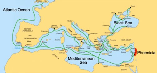
As for a prince indulging himself, again, Mulek may have been a baby when secreted out of the city and carried to the seashore where a ship could be obtained or built. And to what seashore would they have been led? Certainly not to any along the Mediterranean for the Babylonians controlled all the coast and all of Palestine except for Judah and Tyre, and both were under extensive siege. In addition, it has already been established that because of the fierce merchant competition in the Mediterranean at the time, especially with Tartessus near the Straits of Gibraltar, that any Phoenician ship leaving the Mediterranean would have been followed by such competitors to see where it was going.

(See the next post, “How Did Mulek Escape Jerusalem and Where Did They Go?” to see how Mulek escaped from the Babylonian conquest of Jerusalem and the fate of his brothers)

Monday, November 29, 2010

Who Were the Phoenicians? Part VI

Hugh Nibley claimed that “in search of new colonies the Phoenicians were sailing great distances from their home ports of Tyre and Sidon.” Paul Herrman wrote “The very spirit of the age seems to have been at work in the Punic voyage into the immense distances of the ocean, announcing the dawn of a new epoch.” It has also been said that the ancients always chafed at the limitations of their geographical knowledge and were always expanding the distances of their known world.

Nibley has also suggested that “more recent discoveries show that an ancient seafaring nation from the Mediterranean Sea was trading with far off Peru. For example, the New World plants of coca and tobacco having been found in the graves of Egyptian mummies starting in 1070 B.C. Someone had to have brought these commodities from South America. Again, the likely candidates for these ancient drug traders would have been the master sailors of Phoenicia.”

Map of the Mediterranean, showing the extent of Phoenician trade routes and sailing ventures by the 3rd century B.C. Note that except for Portugal, Britain and Gaul, the Phoenicians had sailed nowhere else outside the Mediterranean

First of all, as has already been amply shown, the Phoenicians were never interested in new colonies. They were interested only in ports where their shipping and trading interests could be enhanced. Colonies never accomplished such profit ventures. Secondly, it seems that Nibley has never understood that the Lord told Lehi that his land would be kept form the knowledge of other nations. Phoenicia was a nation. The Lord also said that if other nations became aware of the Land of Promise that they would overrun it and there would be no place in it for Lehi’s descendants.

One of the problems people have, no matter how intelligent and accomplished they are, is that they forget or do not understand that when the Lord covenants with man, he NEVER goes back on that promise.

Nor should we ignore that Phoenicia was a Mediterranean nation, an ancient civilization centered in the north of ancient Canaan, with its heartland along the coastal regions of modern day Lebabon, Syria and northern Israel. It was an enterprising maritime trading culture that spread across the Mediterranean during the period of 1550 B.C. to 300 B.C. In fact, the Phoenicians called themselves Kena'ani (Canaanites), which is Hebrew for "Merchant."

Though ancient boundaries of such city-centered cultures fluctuated, the city of Tyre was the southernmost Phoenician city, with Sidon the northernmost, and Sarepta (modern day Sarafand) between them. They traded by means of a galley, which was a man-powered sailing vessel, and are credited with the invention of the bireme—a ship about 80 feet long with a maximum beam of ten feet with two rows of oars on each side and a square sail. It was later adapted by the Greeks as a warship and even later by the Romans, who used it in the invasion of Britain.

Why people want to credit the ancients with accomplishments they never achieved, is hard to understand, but has led to so much disinformation and the rewriting of history that it is hard to know what is factual and what is someone’s imagination. With the Phoenicians, it would seem some want to make them the discoverers’ of the world—yet, their accomplishments, as great as some were, never left the Mediterranean other than a voyage around Africa under the direction of the Egyptian government, and their sailing to Britain for the purpose of trading in valuable tin.

However, their sailing to the Western Hemisphere in the 6th century B.C. borders on the type of print found about Atlantis, Ophir, and king Solomon’s mines. It is not factual. There is no proof of any kind that the Phoenicians ever sailed out into the Atlantic away from the sight of land. Actual Phoenician records, lately uncovered in the diggings at Sarepta, show their confinement to enterprises within the Mediterranean and list no voyages out into the Atlantic or to any land beyond the ocean.

When the Lord told Lehi that the Land of Promise would be kept from the knowledge of other nations, we might want to believe him. And in such believing, we need to realize that this means the Phoenicians and any other nation or people, except for those the Lord brought to the land. And those he brought were the Jaredites, Nephites and the Mulekites.

(See the next post, “Who Were the Phoenicians? Part VII.” What course did the Mulekites take, and did they build their own ship?)

Sunday, November 28, 2010

Who Were the Phoenicians? Part V

The question seems to be inregard to the ancient Phoenicians, were they explorers and colonizers, or merchants and tradesmen?

Hugh Nibley wrote: “For a long time the Near East had been getting crowded, the pinch being first felt in Syria and Phoenicia--due perhaps as much to deforestation and over-grazing as to population increase. Of this area Ebers writes: "Their small country could not contain its numerous population; accordingly there sailed out of the Phoenician harbors many a richly laden vessel to search out favorable places of settlement for emigrants bound for the coasts of Africa, Crete, Cyprus and Sicily." Such colonies would continue to enrich the Mother city (hence our word "metropolis") by furnishing her with markets and raw materials.”

The problem with this thinking is that in the eras under discussion, such voyages were not conducted by private enterprise—there was no such thing. Enterprise was in the hands of monarchs and kings who were the only ones that could afford such extensive and questionable ventures. The day of privateers was far into the future where thievery and plunder paid for the voyages, but in 600 B.C., the Greeks and Egyptians controlled the Mediterranean with their war ships who were usually in constant conflict trying to protect their expansionist concerns. These type kingdoms expanded their control over areas through conquest and colonization—never for profit of trade.

Phoenician king giving a command to a sea captain where to sail (left) and a Phoenician king checking on the success of his trading empire (right)

In fact, the Phoenicians did not colonize areas. They established ports for trade around the rim of the Mediterranean. These ports, in time, grew into population centers, but for the most part the Phoenicians were interested only in trade—and having ports where they could dock their ships to unload one trade good and obtain another. The fact that they had these centers has caused later historians to believe such ports were “colonies to enrich the Mother city furnishing her with markets and raw materials” were, in fact, ports where loading and unloading could take place. As these ports grew in prominence in the trade world, they attracted other types of merchants and groups who could profit from the Phoenician trade.

The point is, trade ventures were conducted by the Phoenicians with their ventures far and wide limited to known areas where the risk was limited, and to known destinations where the profit of tin and other products was also well known. Ships were expensive to build, especially the type of ships required for cargo space in long-distance trade. It was also expensive to mount a voyage since experienced mariners had to be paid and ships carried upwards of 80 to 100 men to man.

While archaeologists and anthropologists might want to claim that the Phoenicians spent most of their time in the so-called punic voyages of discovery, in reality, they obtained their wealth and accomplishments, and spent almost all their time, within the Mediterranean harvesting and collecting certain shellfish from which a purple dye was made. This process was very involved and timing was critical, thus requiring ships and crews on a timed and regular basis to be in certain locations and reaching certain ports on schedule. This dye, known as Tyrian purple, or royal purple, “fetched its weight in silver at Colophon in Asia Minor.” They also made an indigo dye, sometimes referred to as royal blue or hyacinth purple, which was made from a closely-related species of marine snail and is the route word of which the term “Phoenician” came into being—and stood for “the Purple Empire of the Ancient World.”

The Phoenicians have been credited with sailing prowess far beyond the Mediterranean, but again, in reality, the only voyages the Phoenicians are known to have entered into is that to Pretania (Britain) for tin. As mentioned earlier, tin was the wealth of trade. But the life-blood of the Phoenician trading world was in the purple dye obtained from the shellfish within the Mediterranean.

To consider that the Phoenicians would be involved in punic voyages of discovery and settlement like Portugal, Span, and later Europe, is foolhardy at best. These were merchants, not explorers; they were traders, not settlers. Phoenicia, which was a conglomeration of city-states, like Greece, but had no military interest such as Greece and later Rome, nor any expansionist interests, such as Spain and Europe. Their interest was in the business of trade. Whatever they did, it was to increase their trade business—colonization never did that, nor exploration. Columbus, for all his accomplishments for Portugal and Spain, never earned those monarchs a profit. It took a military venture of conquest and plunder to bring gold back to Europe from the Western Hemisphere.

(See the next post, “Who Were the Phoenicians? Part VI.” Did the Phoenicians sail to the Western Hemisphere?)

Saturday, November 27, 2010

Who Were the Phoenicians? Part IV

For those who still want to claim, despite the last three posts, that the Phoenicians were involved in bringing Mulek to the Western Hemisphere, and that Phoenicia, or some Phoenician sailors, could have conducted such a voyage in 586 B.C., it should once again be understood that Phoenicia was rarely independent of foreign control and direct rule after the beginning of the 7th century (700 B.C. onward). And those who controlled Phoenicia considered Judah their enemy, preventing their vassal state from assisting in the escape from Palestine of any Jewish community, no matter how small.

Map shows the location of Phoenician trading posts established along the eastern Mediterranean around 600 B.C., with a few to the west

One of those recent posts gave a list of such conquests and occupations. After that time the same condition arose. Throughout the 6th century (600-501 B.D.) the Phoenicians were involved in such a fierce mercantile competition in the Mediterranean that they had little time to do anything else. The ships leaving Phoenician ports, especially Tyre and Sidon, were laden with merchandise for sale or trade, and these ships were all busy in sailing among the ports they had established in the northern Mediterranean, a few as far west as Spain, and a couple as far south as Carthage, but ALL within the Mediterranean.

This competition was so fierce, and meant the future to the Phoenician sailors, merchants, and government, that in 530 B.C., they burned the great trading city of Tartessus— a harbor city and surrounding culture on the south coast of the Iberian peninsula (in modern Andalusia, Spain), at the mouth of the Guadalquivir River, and Isaiah's “Tarshish of the proud ships”—which closed the whole western Mediterranean and Atlantic areas to all trade but their own. Such a venture was a calculated risk, but one of desperation to salvage the trading centers around the Mediterranean. Had they failed, they undoubtedly would not have survived as a nation.

Map showing the extent of the Phoenician Trading Route in 600 B.C.

In the seventy years between 600 B.C. and this attack on Tartessus, Phoenicia was involved in a death struggle with Iberian merchants over bringing tin to the eastern Mediterranean and, through those ports, to the eastern world. Since tin was an essential component of true bronze, and comparatively rare, such trade was the life-blood of commerce in the merchant world. All nations required it and whoever controlled that trade controlled the merchant world. As a result, it is unlikely Phoenicia would have been making distance voyages for any reason but trade, nor would they have risked valuable ships to such foolhardy enterprises as taking a small group of people across an unknown ocean that had frightened mariners for a thousand hears before and would for another thousand years after.

The fact that Lehi, in the ship Nephi built, made a deep-ocean crossing, even with inexperienced men handling the sailing chores, was possible only because of the intervention of the Lord. He not only told Nephi how to build a ship that would survive such a voyage (not after the manner of men 1 Nephi18:2) but by giving Lehi the liahona, a compass that worked by faith and told them the course to take.

Phoenician sailors would first of all not had such a device, nor if it was available to them, doubtfully would have trusted their lives to it as heathens believing in Baal. The problem is, that as modern man, we have crossed oceans, gone in any direction we choose, with ease driven over mountain passes that would have given Hannibal pause for concern, and paid very little attention to the difficulties of travel while riding in air conditioned vehicles with two or three hundred horses under the hood and a gas station every few miles. We do not need compasses, nor even directions usually, to reach an unknown destination—especially if we have GPS in our car. Or we travel with someone else driving the bus, taxi, airplane, or ship—we just have to settle back and leave the driving to them.

We forget that in ancient times, a voyage was a major life-threatening venture, taken in questionably serviceable vessels, with no maps, no Stop-n-Go food centers, and no way to adjust to wind, current, or other difficulties. You went where the winds and currents took you, or you stayed close in to shore on coastal voyages. And voyages of great distance cost a lot of money and had to be paid by someone where a profit could be realized. Such a venture to the Land of Promise would only have been undertaken by a king, paying for it out of the kingdom’s treasury, or in the case of Lehi, paid for by individual labor using resources found along a seashore. In 600 B.C. in the eastern Mediterranean, there were no such resources—everything was controlled and “owned” by those kingdoms that surrounded the Mediterranean.

(See the next post, “Who Were the Phoenicians? Part V.” Were the Phoenicians explorers and colonizers, or merchants and tradesmen?)

Friday, November 26, 2010

Who Were the Phoenicians? Part III

It is well known and recorded that the Phoenicians, who called themselves the Canaani (originally Cannanite which evolved to mean "merchant"), though the Greeks called them Phoenicians because of the purple dye they created, began their first expedition of great distance in 600 B.C. around Africa. However, what is usually forgotten is that this journey, which took three years, was only in coastal waters, and only in sight of land. It also involved numerous stops for rest and to refurbish their ship as well as to replenish supplies.

Replica built of the 600 B.C. ship that sailed around Africa. In 2008 this reconstruction of the Phoenician / Mediterranean trading vessel embarked on a journey with a crew of 20 to retrace the Phoenicians' route around Africa. One can easily see that such a ship could not have sailed into deep water across the Atlantic Ocean)

The voyage around Africa was begun as a result of Pharoah Necho of Egypt who, at the time, had brought many Phoenicians into Egypt as a result of an earlier occupation of that northern land—these would have been much like slaves and had no choice in making the voyage. This voyage was neither one of trade nor settlement as all other recorded Phoenician voyages were. Nor was it done for the value of Phoenicia or the sailors, though it is likely they would have secured trading posts or ports along the coastal area for future purposes.

The white line shows the route of the Phoenician sailors in 600 B.C. on their historical route around Africa. The voyage took 3 years with constant stops along the way for overnight stays and replenishment of daily supplies)

After all, Pharaoh Necho, the son of Psammetichus, king of Egypt, raised great armies, and sent out great fleets, as well on the Mediterranean as the Red Sea, and expended a vast sum and many thousands of lives in a fruitless effort to unite and Nile and the Red Sea by a canal. His commission to the Phoenician seamen to sail around Africa from east to west was part of this great, overall plan. This sailing venture had nothing to do with the Phoenicians directly, only that they performed the task.

Before 600 B.C, the Phoenician traveled only short distances in the Mediterranean and along the coast of Portugal, Much later they voyaged along the coast northward to Gaul and across the English Channel to Bretania, what is now England. These voyages were for the soul purpose of trade and purchase of tin in England, which they brought back and used along with copper from Cyprus to make bronze—a highly tradable item at the time.

Since all of these voyages were made by sailing along coastal waters in sight of land with shallow-draft ships used in the day, and would have had men at the oars to supplement a single-masted sail, and steerage was by outboard oar as a rudder, and by furling the sail when in close to the coast, it cannot be concluded that in 600 B.C., Phoenicians were so experience seamen that they could have sailed to the Western Hemisphere, bringing Mulek and the others to the Land of Promise.

The Phoenicians, like the Greeks and the Romans, sailed the Mediterranean Sea. Unlike the others, whose purpose was battle, conquest and expansion, the Phoenician purpose was trade. They established settlements along the northern coast of the Mediterranean and used these ports to move goods and trade. Their purpose was never to conquer, nor was it to settle other than establishing posts and settlements that would enhance their trading purposes.

On the rare and unique voyages outside the Mediterranean, they stayed in coastal waters, and their purpose was to trade—never to settlement. Even in the most unlikely case of taking Mulek to the Western Hemisphere, any Phoenicians involved would not have stayed there, for they never settled any land outside the Mediterranean basin. However, they most certainly would have brought back word of their voyage and the settlement established by the Jews in some far off land—obviously, this would have led to trade and the bringing of others to that land—an event that is directly opposite the Lord’s promise to Lehi. In fact, if such a scenario were to have happened, as Nibley, Sorenson and other Mesoamerica theorists so flippantly claim, the Lord would have been breaking his promise to Lehi at the same time he was making it.

Such is simply not possible!

For those who want to make such claims, they should look into this promise the Lord made to Lehi—a promise repeated by Nephi and others down through the centuries. Such promises may be broken by man, but never by God.

Thus we can see that the Phoenicians would not have made such a voyage, because they 1) did not have the knowledge to do so, 2) did not have the ships and maritime ability to do so, and 3) the Lord never would have been involved in such a way in bringing Mulek to the Western Hemisphere since it would have broken his promise to Lehi.

(See the next post, “Who Were the Phoenicians? Part IV,” for an understanding of the availability of a ship to take the Mulekites to the Land of Promise)

Thursday, November 25, 2010

Who Were the Phoenicians? Part II

Taking nothing away from the Phoenician sailing ability, there is simply nothing in history to suggest that they ever left the Mediterranean and sailed out into deep water. They simple lacked the ship design and sturdy construction to accomplish such a fete.
A typical Phoenician ship design of the first millennium B.C. Such ships moved across the Mediterranean, with longer and larger ships of a similar design used for their naval vessels. None of which could have withstood the constant pounding of a deep water ocean.

The only two recorded occasions of even leaving the protection and security of the inland ocean, the Mediterranean, were coastal voyages. To claim they took Mulek and those with him out into the Atlantic Ocean and braved the deep sea in coastal vessels, without the astrolabe (invented in 600 A.D.,but not used by mariners until the 15th century), the compass (invented in China in 247 B.C., but not used in navigation until the 11th century), quadrant, not invented until 1653, the sextant invented in 1731, or a chronograph—not even available in Columbus’ time and the reason he did not know exactly where he landed among the numerous islands of the Caribbean, and was so many degrees off in his calculation of his return voyage that he nearly missed Spain all together.

To understand the importance of this prior to the knowledge of these instruments and in most reader’s lifetime the common understanding of GPS (Global Positioning Satellites), to determine a position on the Earth's surface, it was necessary (and still is) and sufficient to know the latitude, longitude and altitude. Altitude can be ignored for ships at sea level, but even so, until the mid 1750s accurate navigation at sea out of sight of land was an unsolved problem due to the difficulty in calculating longitude.

Navigators could determine their latitude by measuring the sun's angle at noon (when it reached its highest point in the sky, or culmination). But in Columbus’ time, to find longitude at sea was merely guesswork. Not even Galileo Galilei’s method a century later of observing regular celestial motions based on watching Jupiter's natural satellites, was possible at sea due to the ship's motion--nor did they have any other way to determine a time standard that would work aboard a ship. The Lunar Distance Method, initially proposed by Johannes Werner in 1514, was developed in parallel with the marine chronometer. The Dutch scientist Gemma Frisius was the first to propose the use of a chronometer to determine longitude in 1530.

Thus, Columbus nearly missed his return destination to Spain because he was several degrees off in his “guessing” of these calculations. It has often been cited that the only reason Columbus succeeded in his initial voyage was in his absolute belief the earth’s circumference was much small than it is, and that the orient lay only 2400 miles across the sea, which allowed him to think he could reach India in a short enough time not to run out of supplies. And also his belief that he was pre-ordained to discover the Western Hemisphere (see 1 Nephi 13:12)

So for Hugh Nibley, Sorenson, and others to so flippantly suggest that the Mulekites were guided to the Land of Promise by Phoenician sailors is not only out of the question, it is absolutely absurd.

People of today so often neglect to think about situations that existed in ancient times. Not only do we have to deal with winds and currents, knowing that once leaving the Mediterranean, the Phoenicians in 600 B.C. would have to know to travel south to the Canary Islands, a distance of just over 800 miles. At about 90 miles per day, that southerly direction would have taken 9 days of travel to the south, away from their direction across the Atlantic. Columbus, once reaching the Canaries, traveled another 700 miles southward to the Cape Verde Islands, where he finally turned west. About 1500 miles, or about 17 days in a southerly direction. How would the Phoenicians, who had never been further from the coast of Africa than within sight of its land, or about 25 to 30 miles distance, know to travel 400 miles off the coast to these islands—how would they even know how to find these islands, or the Canaries about 380 miles off the African coast?

2000 years later, Columbus believed incorrectly that the distance from the Canary Islands to Japan was 2300 miles, but others believed correctly that the earth was much larger than Columbus thought, and that the distance from the Canaries to Japan was about 12,200 miles—and that no ship available in the 15th century could carry enough food and fresh water for such a journey.

To believe, and promote an idea that Phoenician sailors could have made such a voyage without significant and extensive divine intervention, is being both naive and gullible. Nor would they have trusted in any divine guidance, as Lehi and Nephi did, for they were pagans and extremely superstitious as were all mariners.

(See the next post, “Who Were the Phoenicians? Part III,” for their sailing ability and whether or not they would have sailed outside the Gates of Hercules—the Straits of Gibraltar—and into the Atlantic Ocean)

Wednesday, November 24, 2010

Who Were the Phoenicians? Part I

Hugh Nibley and other Mesoamerican theorists regarding the location of the Book of Mormon Land of Promise, often turn to the Phoenicians as the means for the Mulekites to have crossed the great deep to reach the Western Hemisphere.

Regarding such a ship, Hugh Nibley claimed it would have been Phoenician because “all the Mediterranean ports of the kingdom of Judah were in Babylonian hands.” However, what he seems to have forgotten and current theorists not realize, is that Tyre, one of the two major Phoenician seaports, and was from about 2000 BC onwards through the Roman period, with ships capable of crossing the Mediterranean and passing through the Gates of Hercules (Gibraltar), was under a lengthy siege of the Babylonians by Nebuchadrezzar II, during the time those who brought Mulek out of Jerusalem.

A 5th century B.C. Phoenician cargo ship (Left) and a 2nd century B.C. grain ship (right). These Phoenician ships of the B.C. era were often light, fast, and maneuverable, built for crossing the Mediterranean and making coastal voyages, such as to Britain for tin. They were incapable of sailing across deep oceans because they lacked strength of hull, ocean going designs, sufficient sail, and rudder capabilities—and their speed was about 8 miles per hour. Other, heavier Phoenician ships were powered by one and two banks of oars and lacked true sailing capability, with speeds far less than 8 miles per hour.

This same Tyre, in the 14th century B.C. was a vassal state of Egypt and in 1300s gained its independence when Egypt withdrew. In 600 B.C., it was subject to Assyria, and in 585-573 B,C. it successfully withstood this prolonged siege by the Babylonians. It would have been impossible for any Jews to have even entered the area of Sidon or Tyre through the Babylonian blockades, let alone to have purchased passage on any ship the Phoenicians had that would have been needed to lift such a siege of Tyre.

Thus, we can see that the Babylonians controlled all the ports along the eastern shores of the Mediterranean. To fully understand this, one needs to know the history of this region at the time in question. Beginning around 689 B.C., about 100 years before Mulek left Jerusalem, the Assyrian king Sennacherib took the main Phoenician port of Sidon, devastated Judah, and destroyed Babylon, though failing to take Jerusalem. In 648, Assyrian king Assurbanipal destroyed a rebuilt Babylon. In 640, the Greek state of Sparta became militaristic and very aggressive throughout the northeastern Mediterranean. In 625, Syria’s capital of Damascus came under Babylonian rule. In 612, Nabopolasser, king of Babylonia conquered Nineveh and divided the Assyrian Empire with the Chaldeans. In 609 Pharoah Necho conquered Josiah and Judah, but was pushed out of Asia by Babylonian king Nebchrezzar at the battle of Carchemish, who four years later defeated Necho and drove the Egyptians out of Palestine, taking over control of Judah. In 586, the year Mulek fled Jerusalem, Nebuchrezzar ended the kingdom of Judah after destroyed Jerusalem and Solomon’s temple. In that same year, Phoenicia was ruled by the Babylonians.

With all that in mind, one might realize that the Phoenicians would not have dared do anything with the Jews from Jerusalem, nor would the Babylonians who then controlled all Phoenician ports, have allowed any Jews to escape since they had taken them captive back to Babylonia.

It should also be understood that by the time of Lehi, the great ports of Phoenica north of Palestine were in decline. For some 2000 years before that, the Phoenicia port cities of Tyre and Sidon had stood alone as "the doorway to the East.” Their men were among the richest and greatest merchants and sailors of the ancient world—with their shipping fleets working the trade routes of the entire Mediterranean Sea. The goods they purchased from Mediterranean countries would then be taken inland to the Red Sea port where they were shipped east. Conversely the exotic wares from the Far East were brought back and sold throughout the Mediterranean. Yet these famous Phoenician trading cities, that had been for many centuries, had outlasted kingdoms, rulers and civilizations because of their trade “partnerships,” eventually fell and were subjugated to the controls of foreign governments, such as Egypt, Assyria and then Babylonia. By the time Lehi left Jerusalem, the Phoenician cities were all under the control of Babylonia, which culminated in complete domination by 586 B.C., the year Mulek would have left Jerusalem.

When people have a pre-determined opinion of direction and final location, they often make a mistake of taking a course toward that destination that, in reality, has no validity in reality at the time of the event. Nibley, John L. Sorenson, and others, who need to place the Mulekites in the Land Northward along the east coast, have often stated that the Mulekites sailed out of the Mediterranean and across the Atlantic. However, in 600 B.C., this would have been an impossible achievement for several reasons.

(See the next post, “Who Were the Phoenicians? Part II,” for their sailing ability and knowledge in 600 B.C.)

Tuesday, November 23, 2010

Danger of Theorizing Part XIII – Weights and Measures & Agriculture

Following are the last three points of the 16 listed by the author claiming all must exist for a Land of Promise location to be taken seriously. They are:

“(8) Merchant Class Using Weights and Measures tied to gold, silver and grain (Alma 11)”

First of all, there is no proof that the Nephites used weights and measures as their monetary system. This would imply that gold and silver were exchanged in bulk or bar/ingot form. Such is definitely impractical in any society. But especially in the case of Zeezrom offering 6 onti of silver to Amulek (Alma 11:25); and also in such understanding as the judges “received their wages according to their employ” (Alma 11:20). None of this would make sense if an onti of silver was a weight in the form of a bar or some other bulk form.

In addition, the Nephite monetary system had been in place for several centuries by the time of Alma’s writing, and when Mormon abridged that record over 400 years later, he saw no reason to alter, change, or explain further, suggesting that whatever system was in place in 82 B.C., was the system used in 385 A.D. Rarely in history, if ever, would you find a monetary system of a 1,000 year old culture (with more than a thousand years history before that in Palestine) using weights and measures for their money exchange. Besides, the Nephite culture by 82 B.C. had been building fantastic buildings, temples, cities, highways, etc. Nor can it be said, as the author did above, state that only the merchant class used money—Zezzrom and his fellow judges were a professional class and not involved in merchandizing of any kind.

For a complete understanding of the Nephite monetary system and how it operated and how it compares to monetary exchange of today, see the future 3-part posting entitled “Nephite Monetary System.”

The second of these last three is: “(13) Must be in the Western Hemisphere but where Joseph Smith could not have known about in 1829”

The author of this list probably included this having a comparison with the Great Lakes and Heartland theories in mind. Obviously, areas and places within the eastern and mid-American area would have been known to Joseph Smith. However, this could also be used to show that the Andean area of South America fits this very well. Joseph would not have known anything about Peru, Chile or Ecuador in 1829. These countries were just obtaining their independence from Spain and divesting themselves of direct Catholic control. Not much commerce or any other news would have been coming out of the Andean area at this time because of the constant warfare going on.

The last of these three is: “(16) An Agricultural Base to support several millions of people, Columbus having visited the area (1 Nephi 13:12).”

First, the agricultural area of Peru and Chile are legendary, and far more than Guatemala and the rest of Mesoamerica in terms of production and food source. The Mediterranean climate of Chile is a producer of just about every kind of food that can be grown. And as for size, the population of Mesoamerica today is about 83-million, and the population of the Andes is about 65-million. Both areas would certainly qualify for the “several millions of people,” but the Andean area is even more productive in the growing of food.

It is always interesting to see how the many theorists pick on those items for proof of location that match their model. However, there are many other points to be included. As an example, what about:

1. Two unknown animals that are valuable to man? (Ether 9:19)
2. Two unknown grains on a par with corn, wheat and barley? (Mosiah 9:9)
3. A metal used for decoration--ziff? (Mosiah 11:3)
4. Highways that go from city to city and from place to place? (3 Npehi 6:8)
5. A society where circumcision was practiced under the Law of Moses? (2 Nephi 5:10)
6. Herbs, such as quinine, that cured fever? (Alma 46:40)
7. Climate where seeds from Jerusalem would grow abundantly? (1 Nephi 18:24)
8. A land where towers were built and remains are still found? (Mosiah 2:7; 11:12-13)
9. A land where winds and currents flow to from the Arabian peninsula? (see any Atlas)
10. A land of Promise that is an island as Jacob said? (2 Npehi 10:20)
11. A land that has “mountains whose height is great”? (Helaman 14:23)

The list could go on, but suffice it to say that only the Andean area of South America can qualify for ALL the points that could be raised about the Land of Promise as shown and listed in the Book of Mormon as has been pointed out and listed in numerous other posts.

Monday, November 22, 2010

Danger of Theorizing Part XII – Two Highly Literate Societies

Another of these points has to do with two distinct languages both spoken and written in the Land of Promise. According to the author of these sixteen points he requires to be met in order to determine a Land of Promise site, there must exist:

“(5) Two Highly Literate (Written Language) Societies living adjacent to but separate from each other between 550 BC and 200 BC, one of which lived "far northward" from the other. They must have coexisted for at least 250 years.”

Peru, of course, has boasted only two languages for millennia, with Quichua and Aymara the languages of the two distinct groups of people in the Andean area. This is even true today, where these two languages dominate all the natives over the entire Andean area. Quichua, of course, is the predominant language that survived among the natives from antiquity clear into Inca times.

Aymara (Aymar aru) is one of the major languages (of which there are 8 to 10 dialectic varieties) of South America, spoken by more than two million people in the Andean region of Bolivia, Peru, Chile and Argentina. Some linguists think Aymara may be distantly related to Quechua, but this has not been conclusively shown.

Quichua (Quechua) is a native South American language family and dialect cluster spoken by 6 to 8 million people primarily in the Andes of South America (called runa simi by indigenous Andean people), and derived from an original common ancestor language. Quichuas specifically is spoken in Ecuador (also called Kichwa), highlands in north-central Peru, and highlands of southern Peru, including the Puna, Bolivia, and north-western Argentina.

It is interesting that a Mesoamerican theorist would pick the subject of two distinct languages when the area of Mesoamerica had numerous such languages back into antiquity. John L. Sorenson comments liberally about these different languages as his excuse to claim that other than Jaredites, Nephites and Lamanites occupied the Land of Promise—as did Hugh Nibley before him, a linguist of the highest order.

The major problem here is the literacy factor. Written languages have been found in Mesoamerica—they have not been found to any degree in the Andean area of South America. However, in the book, “Lehi Never Saw Mesoamerica,” this subject is covered quite thoroughly regarding the written languages that have been found coming out of Peru.

In fact, any written language surviving within the area of the Land of Promise from Nephite times is more suspect than it is supportive. The reasoning for this is simple. Nephite prophets time and again showed their concern over the Lamanites finding their records, for they knew the Lamanites would destroy them—in fact, the Lamanites would have destroyed anything Nephite because of their hatred. As Mormon said, “having been commanded of the Lord that I should not suffer the records which had been handed down by our fathers, which were sacred, to fall into the hands of the Lamanites, (for the Lamanites would destroy them)” (Mormon 6:6), it would be difficult to find any records of a written language in the Land of Promise once the Lamanites had annihilated the Nephite nation and purged the land--carvings in stone on large structures undoubtedly the only thing that survived.

While Mesoamerica structures were built of rock (there were few walls) and stone, which survived into our time, their carvings on the buildings also survived—which is the source of the written language of the Maya, etc. In Peru, while stone and rock were used to build the defensive walls, almost all of the building structures were made of mud brick and adobe, which did not survive the centuries, thus there were no carved edifices showing a language. And those few rock structures, like Tiwanaku, were utterly destroyed by later societies.

By the time the Spanish Conquistadores entered the Andean area, there was no written language had among the Lamanite descendants—and to think there would be such is simply a lack of understanding of the conditions Mormon and others wrote about. But to think that ancient Peruvian people did not have a written language in light of their fantastic accomplishments is foolhardy.

In fact, the history of early Easter Island emigrants claimed to have brought a written language with them from Peru. Today, that language is called Rongorongo and has withstood all attempts at interpretation.

In addition, the ruins of Tiwanaku when the Spanish first saw them may well have held carvings of some type, however, the Spanish, then later the Peruvian railroad, not only tore down all the ruins there, but broke them up into crushed rock for the rail beds. Then, too, the written Rongorongo language taken to Easter Island from Peru shows a written language of the ancient Andean area. But nothing remains in Peru, Ecuador or northern Chile today to verify any written language. And if Mesoamerica ruins had been decimated by the superstitious and sanctimonious Spaniards to the etent of Peru, we would not know of any written language of the Maya.

Saturday, November 20, 2010

Danger of Theorizing Part XI – Warrior Class and Sophisticated Fortifications

Another of these points has to do with a warrior class of people in the Land of Promise, and sophisticated fortifications. The author of these sixteen points required to be met in order to determine a Land of Promise site, there must exist:

“(11) Warrior Society - Great Battles, Structured Armies, Sophisticated Fortifications“

The first two of these three requirement stated above could probably be found in all societies across the Western Hemisphere for seldom does one find in antiquity a peaceful people without a warrior class and structured armies of some sort. The third part, sophisticated fortifications is another matter. But let us take them one at a time.

1. Warrior Society with Great Battles. The structure of the Andean area in South America is one of continual battles of a warrior society from the most ancient of records right up to the period of the Inca before the Spanish arrived. Warfare moved back and forth across this Andean area, especially in the middle areas of Peru and southern Ecuador.

2. Great Armies. The roads that criss-cross the Andean area long held the movement of armies marching forth, dating back into B.C. times. Archaeologists have given all these different societies names, though in reality they were all Nephites or Lamanites, but show that each society they name was supplanted through war by another, strong society. This happened for at least two thousand years in the Andean area right up to 1541 when the Spanish defeated the Inca, the last of the native warrior societies.
3. Sophisticated Fortifications. Scattered all over the Andean area are both major fortresses and small, minor lookout forts (called resorts in the Book of Mormon). The Andes is a series of canyons and valleys and along almost every mountain pass, canyon wall, and hillsides overlooking where an enemy could approach, these small resorts or forts can be found.

In addition, there is a unique feature found in Peru and that is a series of fortified walls stretching from east to west across the land whose purpose, archaeologists claim, is to keep a southern enemy from gaining further ground to the north. Perhaps the most famous of these walls is dubbed “The Great Wall of Peru,” which stretches from the Pacific Ocean for a hundred miles inland, down through valleys, across river beds, and up over mountains. The wall is as high as fifteen feet in most places, but higher where it dips down into river beds, and was built with its north side easily scaleable by a defending army, but the south side is steep and slick, almost impossible to scale.

Discovered by Shippee and Johnson in 1931 in an aerial reconnaissance of Peru, most of the wall is not even observable at ground level because of the forests, mountains and riverbeds. Nor is most of it accessible because of the inhospitable terrain. Built of large rocks and mortared in place, the wall matches closely the wall that Moronihah built to successfully stop the northern advance of the Lamanits, which enabled the Nephites to then gain back much of the land to the south lost earlier.

While almost any location could boast of ancient armies, wars, and military societies—which describes the American Indians of North America as well as throughout the Western Hemisphere--the fortifications of the Andean area set apart South America as a perfect match for this point. The fortress of Kuelap (shown here) is a most convincing fortress built for defense, as is the fortress of Sacsahuaman above Cuzco.
In fact, while most cities now viewed in Mesoamerica were obviously not built for serious defense, just about every structure in the Andean area of South America shows a strong defensive purpose in its construction. In fact, most archaeologists who have worked on the ruins in the Andea area have commented on how the temples, palaces, cities, etc., were all built with strong defenses—more so than anywhere else in the Western Hemisphere.

Friday, November 19, 2010

Danger of Theorizing Part X – Legends of a White and Bearded God Part II

In the last post the comments of a white god as written by Pedro Cieza de Leon in 1541 was listed. Continuing with the information regarding the legends of a white god who visited the Peruvian area in antiquity, the following is from Pedro Sarmiento de Gamboa.

Gamboa (often called Sarmiento) was a celebrated navigator and captain in the Spanish army. While stationed in Cuzco, Peru, he was ordered by the Viceroy, Francisco de Toledo, to compile a history of the natives. Summoning some of the oldest wise men still living in the ancient Inca capital, Sarmiento interviewed them individually, then compared their testimonies to draw his conclusions and make his compilation.

The manuscript he prepared was called Historia de Los Incas, La Segunda Parte de La Historia Llamada Indica, the second of what was originally projected to be three separate books. The manuscript remained unpublished in the custody of the Spanish crown for many years, finally finding its way by sale to the library at the University of Göttingen, [Germany], where it was discovered and published in 1906. Sarmiento’s version of the white god legend is as follows:

“All the Indians agree that they were created by this Viracocha, who they believe was a man of medium height, white and clothed in a white robe gathered around his body, and that he carried a staff and a book in his hands. After this, they tell a strange story; that is, that after this Viracocha created all the people, he came walking to a place where a large group had congregated … Viracocha continued his journey, doing the works of piety and instructing the people he had created … and wishing to leave the land of Peru, he gave a speech to those he had created, advising them of things which were to happen in the future. He warned them that people would come saying that they were the Viracocha, their creator, and that the people should not believe the impostors, but that in the coming ages he would send his messengers to teach and support them. And having said this, he and his two companions went into the ocean and walked away over the waters, without sinking, as if they had been walking on land.”

Then there is the record of Juan de Betanzos who was among the first conquistadores who invaded Peru with Francisco Pizarro. Immediately upon entering the country, he began studying Quechua, the language of the Incas, until he became proficient enough to be named official interpreter for the royal court. He was skilled enough in the native language that his first publications were Spanish-Quechua dictionaries. Betanzos married one of the former Inca princesses and lived in Cuzco, compiling data and observations first hand until 1551, when his major treatise on the traditions and history of the Andean Indians, Suma y Narracion de Los Incas, appeared. He took special care to preserve the “order of speaking of the natives” in his writings. This is Betanzo’s description of the god Viracocha:

“Asking the Indians what idea or figure they had of this Viracocha when the ancients saw him according to their traditions they had received, they told me that he was a man of tall stature, and that he had white clothing that came to his feet, and that his robe he had drawn at the waist, and that he had short hair, and that he had a crown on his head like a priest would wear, and that he walked with his head bare, and that he had a certain thing in his hands that looked to them like the small religious books the priests carry around with them today. I asked them the name of this person in whose honor the stone monument was erected and they told me that he was called Con Tici Viracocha Pachayachachic, which in their tongue, means, ‘god, creator of the earth.’ ”

An additional account is from an Indian of the southern sector of the Inca empire who prided himself on having been “Christianized.” He wrote under the unwieldy name of Don Joan de Santacruz Pachacuti Yamqui, and his manuscript, a curious mixture of Spanish and Quechua words, remained unpublished until 1880. Santacruz Pachacuti’s version of the white god tradition, though, is most interesting:

“Some years after the devils had been cast out of this land, there came to these provinces and kingdoms of Tabantinsuyo a bearded man of medium build with long hair, wearing a rather long tunic, and they say that he was more than a youth. He had white hairs, was slender, walked with a staff, and he taught the people with great love, calling them all his sons and daughters. When he journeyed through the provinces he performed many miracles visibly: he healed the sick by touching them with his hands. He had no belongings or possessions, and spoke all of the languages of the provinces better than the natives, and they called him Tonapa or Tarapaca Viracochanpa Chayachicachan or Pacchacan and Bicchhaycamayoc Cunacaycamayoc. He chastised the people with great love and they listened to him with rapt attention, receiving what he preached to them, indicating and emphasizing each chapter of the discourse.”

Legends in Mesoamerica fall far short of these extremely detailed accounts, shortened her for sake of space, but extensive in their descriptive nature of this white God.

Thursday, November 18, 2010

Danger of Theorizing Part IX – Legends of a White and Bearded God

Another of these points has to do with Legends of a White and Bearded God in the Land of Promise. The author of these sixteen points required to be met in order to determine a Land of Promise site, there must exist:

“(12) Legends of a White and Bearded God“

Naturally, such a requirement is an absolute must. But it is not limited to Mesoamerica. In fact, the legends in Peru are even more fascinating.

First of all, it is well-known that almost all Indian tribes in the Western Hemisphere preserve oral traditions about the ancient appearance of a white god who came down from heaven to instruct and organize his people. Some of the most interesting versions of this widespread tradition come from Peru, where this legendary deity is known variously as Kon Ticci Viracocha, Tunupa, Pachacamac, Tarapaca, or Arnauan, depending on the region of the country being considered. Four of the more highly acclaimed Peruvian historians, Pedro Cieza de Leon, Sarmiento de Gamboa, Betanzos, and Santacruz Pachacuti, have written especially interesting accounts of this white and bearded god, and when considered together, they give us a reasonably detailed description of the traditional hero’s physical appearance, personality, and activities among the ancestors of the Andean Indians.

Pedro Cieza de Leon arrived in Peru in 1548 as a simple soldier in a military group sent to quell an uprising that had turned into a civil war between the Spanish rulers of the country. He remained until 1550, during which time he visited almost every part of the newly conquered land, observing and recording descriptions of the terrain, the plants, the customs of the natives, and the major facets of their history. He had been keeping a journal of his observations ever since beginning his travels in Colombia in 1541, but now Cieza became fascinated with the idea of writing a history of Peru and its peoples. After completing his military duties, he would interview the amautas and orejones, the surviving wise men and noblemen of the Incas, as well as qualified Spaniards to learn all he could about the history and traditions of the conquered Inca empire.

“Before the Incas ruled, or were even heard of in these kingdoms, these Indians speak of another thing much greater than all others which they tell, because they affirm that they went for a long time without seeing the sun, and, that, suffering tremendously with this deficiency, they raised great prayers and supplications to those they revered as gods, asking them to restore the light they lacked; and in this manner, there arose from the island of Titicaca, which is in the great lake of Collao, the sun shining brilliantly, which made them all very happy. And afterwards, they say that from the land of the noon sun, there came and appeared to them a white man of large build whose aspect and person showed great authority and veneration, and this man had such supreme power that he levelled the mountains and raised up the plains into large hills, making water flow from boulders; and since they recognized his supreme power, they called him the creator of all things, their originator, father of the sun, because even this notwithstanding, they say that he did many greater things, because he gave life to men and animals, and from his hand, they received notable benefit. According to the Indians who told it to me, who heard it from their fathers, who also heard it in the songs they preserve from antiquity; this man went towards the north, working many miracles in his journey through the mountains, and they never saw him again. In many places they say that he gave commandments to the men about how to live, and that he spoke with love and much humility, admonishing them to be good and not cause harm or injury to one another, but instead, to love each other and have charity. Generally they call him Ticiviracocha, even though in the province of Collao, they call him Tuapaca, and in other places he is known as Arnauan. Many temples were built to him in different places, where they erected stone statues in his likeness before which they offered sacrifices. The large stone figures in the city of Tiahuanacu are said to date from that era, and even though by tradition inherited from the past, they recount this that I tell of Ticiviracocha, they say nothing else about him, nor that he ever returned to any part of this kingdom.”

White Bearded God represented on the 10-ton gateway to ancient Tihuanacu (Tiwanaku). It would be hard to find any other Western Hemispheric civilization with such documented information regarding a white and bearded God, than what has been recorded by several historians of the time in Peru.

(See the next post on the White God, quoting other historians of the period)

Wednesday, November 17, 2010

Danger of Theorizing Part VIII – Narrow Neck of Land

Another of these points has to do with the Narrow Neck of Land that separated the Land Southward from the Land Northward. The author of these sixteen points required to be met in order to determine a Land of Promise site, states:

“(6) A small, narrow neck of land dividing the land Northward from the land Southward (Alma 22:32, Heleman 3:8, Ether 10:20)“

This is another of those points that simply does not fit Mesoamerica. The point of a narrow neck in their model is the Isthmus of Tehuantepec, an area 140 miles from the Bay of Campeche to the Gulf of Tehuantepec. See the map below:

As can plainly be seen, the narrowing of the land in this area is only slight, and would hardly even be noticed when moving along the north or south shorelines. Today, of course, with satellite photos, map making, and aerial photography, a person can tell there is an actual Isthmus, though quite wide, it is still a narrowing of the land in Mesoamerica. But in 600 B.C., in 421 A.D., etc., no one could have obtained a position to have viewed this slight narrowing of the shoreline. The gentle curve of the north shore in the Bay of Campeche, the distance from one vantage point to the other is 340 miles. In the Gulf of Tehuantepec, the distance is 375 miles.

That is, a person’s view of the narrow of the shoreline in the north coast would have to cover about 340 miles to notice a narrowing of the land. That distance along the south coast would be 375 miles. Obviously, no one can see anywhere near that far with the naked eye and, therefore, could not have seen any narrowing of the land to know there was a “narrow neck of land.”

In addition, any qualified narrow neck would have to allow a ship to be launched into the west sea and be able to sail to the north. We find in Alma that when Hagoth’s ships were launched into the west sea: “they took their course northward” (Alma 63:6). In Mesoamerica, it is impossible to launch a ship from the narrow neck of land—the Isthmus of Tehuantepec—and sail northward. As the map shows:

In order to leave the Mesoamerian Narrow Neck of Land, a ship would have to sail 120 miles in a south-southwestern direction, then 25 miles in a west direction, then 750 miles in a west, northwest direction, for a total of 895 miles before it could reach a point where it could turn northward.

Simply put, there is no Narrow Neck of Land in Mesoamerica. And any attempt to claim that the Isthmus of Tehuantepec was the narrow neck of land described by Mormon is without merit.

Thus, while the requirement for a Narrow Neck of Land is certainly one of the points that is made in the Book of Mormon to describe the Land of Promise, Mesoamerica does not qualify as having such a feature.

Tuesday, November 16, 2010

Danger of Theorizing Part VII – Working with Precious Metals and Stonework

Another of these points has to do with working with precious metals and stone of the Nephites. The author of these sixteen points required to be met in order to determine a Land of Promise site, states:

“(10) Highly-skilled Craftsmen - working with Precious Metals, Stonework (Hel.6:11)”

Now this one is almost laughable. The stonework of craftsman in the Andean area of South America, especially in Peru, is unmatched anywhere in the world. Engineers today cannot understand how the walls of huge stones could have been crafted, carved, and moved into such superior fittings and without mortar that not even a piece of paper or knife blade can be inserted between them.

The stepped pyramids and structures of Mesoamerica are, without exception, amazing accomplishments. However, that stonework does not even compare with what is found in Peru. As one engineering journal has stated: “The laying of the stones are impossible for ancient man to accomplish unless they were more advanced in engineering than we were some 50 years ago! Unless they already had Brown's Gas, they could not have created this facade. It would also have required laser and computer backup to do preliminary requirements for future stones. Overunity might have been known back then, but the keyword plyability, was needed in order to "lock" these stones due to the potentiality of earthquakes. These ancients did not put the base stones down but they did put little stones on top of the highly engineered bases. When the Spanish built their churches on top of the base stones, the earthquakes destroyed them but the old stones still stood easily. Meaning, the ancients were highly advanced.”

The stonework in the Andes demonstrates the tremendous construction skills of the early Andean people. Stones of up to 125 tons make up many of the buildings found in the area, Tiwanaku itself is as much a marvel of engineering as it is of early spirituality. Though it predates the Incas by more than a millennium, the ruins suggest an advanced irrigation system, using raised fields, and the ability to transport large amounts of stone over long distances. Tiwanaku has many stone gates of huge proportions and some stones weighing over 100 tons, which align with the arc of the sun on the solstices or equinoxes. Some experts claim that early Andeans had decoded the migration of constellations and and incorporated these patterns into the structures as well. The hills around Tiwanaku have huge ruined cities, and south of the city of Llave there is the most beautiful stonework that can be imagined, but it can only be seen from the air, like the canals around Lake Poopo and the Nasca lines.

As for the metalwork, the working of precious metals in Peru is legend. Their skills outstripped any other by centuries, and were comparable with those of the highest order of Europe of a later date. The designs of these ancient workings are remarkable and unmatched anywhere else in the Western Hemisphere.

Simply put, metalworking in Mesoamerica dates no earlier than the first century B.C., and actual archaeological findings show it not present before 900 A.D. A fact John L. Sorenson bemoans in his book “An Ancient American Setting for the Book of Mormon,” claiming that “we can only hope that some future findings will show metalwork was done anciently in Mesoamerica.”

Again, the disingenuous approach by the author of this website is evident in such claims that simply do not match the record. Mesoamerica in most of these 16 points simply does not satisfy the points, whereas the Andean area of Peru does in all cases that can be traced to the Book of Mormon record and not to someone’s imagination or localized findings in a particular model.

Monday, November 15, 2010

Danger of Theorizing Part VI – Calendaring and Dating Systems

Another of these points has to do with a calendaring system used by the Nephites. The author of these sixteen points required calendaring to be met in order to determine a Land of Promise site. He states:

“(7) Multiple, functional Calendar and Dating Systems”

First of all, and the main point here is that, there is no mention of any calendaring in the scriptures. Thus it simply cannot be used as a criteria for a suggested Land of Promise site. Of course, Mesoamerican theorists would like to claim this, because of the famous and highly controversial Maya Calendar, and the less known Aztec Calendar—both stone carvings found in Mesoamerica.

But the fact of the matter is, there simply is no mention in scripture of calendars or anything like it.

Basically, the Book of Mormon writers reckoned their time by the number of years since an event. This is shown in the first verse in Alma: “Now it came to pass that in the first year of the reign of the judges over the people of Nephi” (Alma 1:1), and “thus ended the eleventh year of the judges” (Alma 1:9), or “in the commencement of the fortieth year of the reign of the judges over the people of Nephi” (Helaman 1:1), or “that the ninety and first year had passed away and it was six hundred years from the time that Lehi left Jerusalem” (3 Nephi 1:1). Mormon equates the years according to his age: “Therefore it came to pass that in my sixteenth year I did go forth at the head of an army of the Nephites, against the Lamanites; therefore three hundred and twenty and six years had passed away.” (Momron 2:2)

The closest we come in the Book of Mormon to a system of reckoning, is: “And now it came to pass, if there was no mistake made by this man in the reckoning of our time, the thirty and third year had passed away” (3 Nephi 8:2)

The thing is, we do not know the system of reckoning among the Nephites. We do know they had observatories to determine the time of year for such things as planting and harvesting since several have been found in the Andean area of South America as well as in Mesoamerica--in fact, almost all ancient cultures had some type of observatory for such important dates. But for a multi-functioning calendar, that is simply someone’s idea to inject the Maya Calendar into the Book of Mormon. No such concept is ever mentioned in the Book of Mormon.

The Dating System used by the Nephites is also unknown, however, it can be assumed they had such, since both years and events were of major importance, especially from the time that King Mosiah ended the kingship method of government, and instituted the government of judges (Mosiah 29:11; 26) which took place in 92-91 B.C.

In addition, Alma writes that “there were some who died with fevers, which at some seasons of the year were very frequent in the land” (Alma 46:40), which could be assumed to be in the summer months—but no mention of any calendar or reckoning system is even implied. Nor is any mention of the Jaredite or Nephi planting seasons implied—we only know they planted their seeds brought from their old homelands (1 Nephi 18:24; Mosiah 9:9; Ether 6:13).

It is disingenuous for any scholar or theorist to make adamant claims that cannot be shown to exist within the Book of Mormon record. The fact that we can assume the Nephites had some type of calendaring and dating system is probably a given, yet we do not know what that was, nor do we have any record of it in the scriptures by which to claim such a system and its “multi-functional” method having to exist.

If one is going to claim certain points must be met, they HAVE to be taken from scripture, not from something found in some location.

Sunday, November 14, 2010

Danger of Theorizing Part V - Gold and Silver a Criteria

Another of these points has to do with Gold and Silver. The author of these sixteen points states:

“(15) The land must show evidence of substantial gold and silver in the Land of First Inheritance, the Land of Nephi, the land of Zarahemla and the land of the Jaredites. (Helaman 6:9).”

Actually, the author of this should have pointed toward Nephi’s statement: “And it came to pass that we did find upon the land of promise as we journeyed in the wilderness…all manner of ore, both of gold, and of silver, and of copper” (1 Nephi 18:25).


Both Gold, Silver, and Copper in a single ore sample

Now, this statement by Nephi is extremely important and overlooked by Book of Mormon scholars and theorists. “Both of gold, and of silver, and of copper.” The word both means two, that is “two, as considered distinct from others, or by themselves.” At first glance, one might think Nephi used improper language in stating “both” and then followed with three items. However, Nephi was correct in this usage, as was Joseph Smith in translating it.

Gold and silver are precious ores, and of the same kind. Copper in not a precious ore, and is a different kind. Thus, “both gold and silver” is one kind, or precious ores, “and of copper” is a separate kind, or a non-precious ore. Thus, both gold and silver as one and copper as another.


Gold, Silver and Copper bubbled in a single ore

The importance of this is not in the grammar, but in the concept of ore. When gold and silver and copper are mentioned together, it refers to a single ore that contains all three metals. That is, Nephi, who by this time had become quite an expert in ore containing metals for the Lord has so instructed him (1 Nephi 17:9), found ore in the Promised Land that contained gold, silver and copper within single ore.

Interestingly, such a combination is found in abundance in Chile and Peru, but rarely in any other place in the Western Hemisphere. In the book “Lehi Never Saw Mesoamerica” the ore and mines in the Western Hemisphere are covered, including the extensive mining in Chile and Peru of gold, silver and copper in single ore. In fact, Chile is the world's largest copper producer and hosts about 30% of the globes known copper resources and accounts for over 35% of global copper production. Much of this copper is found within ore that also contains gold and silver. The latter is mined for the sole purpose of paying for the mining and production of copper.

According to the U.S. Geologic Mapping of ores in the Western Hemisphere, gold, silver and copper in single ore is found only in one location in Honduras and nowhere else in Mesoamerica. But, again, it is found in numerous sites in Chile and some in Peru.

When this author makes the statement: “Other locations may meet some of the following criteria, but only Mesoamerica meets all these elements required by the book itself,” he is making the same mistake almost all Book of Mormon scholars and theorist make. They get so involved in proving their model, they ignore the facts that are easily checked by anyone so interested. Part of the problem of people buying into someone's theory, is they do not check out the facts and references involved.

In addition, Peru is the fifth largest producer of gold in the world, behind Africa, China, Australia and the United States. Chile is the 14th largest producer of gold. Mexico is the 18th largest, producing only 17% of that of Peru. Guatemala is 36th in the world, producing only 2.5% of that of Peru. Honduras is 39th.

So where is the all-important match of Book of Mormon criteria in his list of points?

Saturday, November 13, 2010

The Danger of Theorizing – Part IV – Cement

Continuing with the sixteen points listed in the website of the Book of Mormon Archaeological Forum, the following picks up with point #4:

“(4) The area of the northern culture must contain evidence of many cities made out of cement. (Helaman 3:3-18)”

Helaman makes the following statements regarding this issue: “And there being but little timber upon the face of the land, nevertheless the people who went forth became exceeding expert in the working of cement; therefore they did build houses of cement in the which they did dwell” (Helaman 3:7); “And the people who were in the land northward did dwell in tents, and in houses of cement” (3:9),

Two important points should be made here: 1) Only residential houses are indicated that they were made of cement, and 2) it is not likely that a house would be made entirely of cement, since cement requires some type of framework. Today that framework is metal rebar within the cement, and metal frames for doorways and window openings. In the tiem of the Nephites, it is likely these areas were supported with rock, and that the cement was used as mortar to cement the rock together. According to the website “Mormon Mesoamerica,” the Ancient Mesoamericans “made a type of “cement” out of limestone. It was then used as a plaster overcoat on top of rubble and stonework.”

The same type of construction was used in places in South America, where a type of limestone cement was used as a covering over rock.

Also “(9) Engineers to Build Temples, Towers, and Highways, using Cement.”

However, the scriptures do not say that those in the Land Northward built temples out of cement. It says “they did suffer whatsoever tree should spring up upon the face of the land that it should grow up, that in time they might have timber to build their houses, yea, their cities, and their temples, and their synagogues, and their sanctuaries, and all manner of their buildings” (Helaman 3:9).

Thus, it should be noted that temples, synagogues and major structures and “all manner of buildings” were not built until the trees had grown so that “in time they could use timber” for such construction.

In addition, it should be noted historically that “The Maya constructed cities with complexes that could cover many football fields and pyramidal ones that rose to heights of 230 feet, yet they built their cities with Stone Age technology. No steel beams supported pyramids or vaults, no metal tools were available to quarry stone or to carve it. Instead, wooden beams, stone, and lime cement were the structural building blocks; rope-and-water abrasion and stone and obsidian tools provided the basic technology of Maya cities.

The same can be said of all the temples and major construction found in ancient Peru, northern Chile and Ecuador, including western Bolivia. Referred to as the Quicha technique by the University of Peru, earth was utilized as a secondary filling element, to which straw, plaster and cement (limestone) are added. The foundations were made of plain concrete with considerably large stones, utilizing one part of cement, 4 of sand, 6 oof pebbles or stone, and ten of large stones, plus water. The thickness of these ancient foundations were at least twice the width of the wall built upon them. Mostly their major buildings were made of cement and carved stone in the north, and mudbrick, adobe, rock and wood in the south.

Lastly, Helaman says, “And thus they did enable the people in the land northward that they might build many cities, both of wood and of cement” (3:11).

While it is true that buildings and structures in the Great Lakes and Heartland areas of present day United States were not built of rock or cement, it would probably surprise most people to learn that the ancient Egyptians used concrete in the construction of buildings, and the Romans had refined the art of concrete making down to a precise technology, and such construction is found throughout the Andean area of South America as well as Mesoamerica. Thus, cement cannot be used to prove Mesoamerica is the Land of Promise any more than it can be used to prove the Andean area is the Land of Promise.

Friday, November 12, 2010

The Danger of Theorizing – Part III – Major Cities

As stated in the last post, a friend sent me info from a website of “the Book of Mormon Archaeological Forum” in which 16 scriptural points were listed as having to exist for any site claiming to be the Land of Promise in the Book of Mormon to be considered. Last post we discussed point 14 and its inaccuracy.

“(3) High Civilizations with Kings and Priests and City-States with scribes as important officers and evidence of many major cities surrounding the Narrow strip of mountainous wilderness. No other theory can show this fact.”

First of all, there is no mention of a mountainous wildnerness. This strip of wilderness mentioned in Alma 22:27 only states that it lies between the Land of Nephi and the land of Zarahemla. Since “wilderness” literally means “a tract of unoccupied land,” it can mean any topography so long as it is not permanently inhabited.

Thus, we must eliminate that requirement.

Second, there is no mention or suggestion of city-states in the scriptural record. In the Land of Nephi, we know that there were sub-kings (Lamaoni) and an overall king (Lamoni’s father), which might qualify for a city-state, but in the Land of Zarahemla and the Land of Bountiful, there is no such suggestion.

There is no mention of a king or city-state leader, or any leaders other than judges, after the time of king Mosiah II, and at no time during Mosiah I, Benjamin, or Mosiah II, is there any mention of a city-state arrangement. Only a mention of cities and their lands, which also included other cities within those lands.

King Zeniff, King Noah and King Limhi, were not in the Land of Zarahemla, but in the Land of Nephi temporarily, and the Lamanites never considered them a separate city state, but a vassal of the Lamanites. Nor can we say that scribes as important officers are mentioned.

As for cities surrounding the area of the strip of wilderness separating the Land of Nephi and the Land of Zarahemla, we only know that the Lamanite occupied areas high up in the highlands, with the city of Lehi-Nephi (city of Nephi), Shemlon and Shilom probably being the closest one to the Land of Zarahemla. Trying to place specific cities in specific areas other than the City of Nephi and the City of Zarahemla and the city of Bountiful, is extremely hazardous with the bare information provided in the scriptures.

As for the most ancient civilization in the Western Hemisphere, archaeologists claim it is the city of Caral, 170-acre settlement in the arid Supe Valley 120 miles north of Lima and just inland from the coast. Not only is it the most ancient city in the Americas, it predated the Inca by 4000 years, and was flourishing a century before the pyramids of Gizeh. It has six stepped pyramdis, the tallest is 4 stories tall with a base of 500 feet It also has many other small platforms, two sunken circular plazas and diverse architectural features including densely packed residences.

Civilization in South America has the largest ancient regisgter, spanning fro 4,500 years from Norte Chico to the Inca Empire. Caral’s date is by carbondating reed and woven carrying bags that were found on the site. These bags were used to carry the stones used for the construction of the pyramids.
The town itself had a population of approximately 3000 people. But there are 17 other sites in the area, which allows for a possible total population of 20,000 people in the valley. An even older city has been recently uncovered in the same general area north of Lima referred to as Sechin Bajo, considered to be 500 years older than Caral.

(See next post, “The Danger of Theorizing – Part III” for the remainder of these points)

Friday, November 5, 2010

The Danger of Theorizing – Part II – Major River

As stated in the last post, a friend sent me info from a website of “the Book of Mormon Archaeological Forum” in which 16 scriptural points were listed as having to exist for any site claiming to be the Land of Promise in the Book of Mormon to be considered. Last post we discussed point 14 and its inaccuracy. Below are the other 15 points with comments:

“(1) Major River flowing from South to North (Alma 2:15, 22:27).”

It is unlikely that any river’s location and course would have remained constant through the upheaval “thus the face of the whole earth became deformed” because of the quaking of the earth (3 Nephi 8:17), and “the whole earth was about to divide asunder” (3 Nephi 8:6), and the earth was carried upon cities with great mountains forming (3 Nephi 8:10), and “the higheways were broken up, and the level roads were spoiled, and many smooth places became rough” (3 Nephi 8:13), and “the rocks were rent in twain.and found inbroken fragments, and in seams and in cracks, upon all the face of the land” (Mormon 8:18), all of which lasted for the space of three hours (3 Nephi 8:19). The only mention of the Sidon River after these events is in Mormon 1:10 in which they are referred to as “the waters of Sidon” not the Sidon River as prior to the cataclysm. We do not know from scripture whether or not these waters remained as a river and flowed to the sea in the last 400years of the Land of Promise topography, as they did before the cataclysm. To make this an absolute (and first) claim seems out of place here.

“(2) A Major River originating from a mountainous narrow strip of wilderness that runs from "the sea east even to the sea west" and serves as a natural feature providing protection from the Lamanites (Alma 50:11).”

First of all, the river did not provide the natural feature of separation, but the narrow strip of wilderness did (Alma 22:27). Second, one can read in this verse that the a river originated in the narrow strip of wilderness and ran to the west sea; however, it is not conclusive. We know from other scripture that the narrow strip of wilderness ran from the west sea to the east sea, separating the Land of Nephi from the Land of Zarahemla (Alma 22:27). Obviously, there was the head of a river along this narrow strip, but the verse does not say specifically that it ran clear to the west sea—only that the line between the two lands ran from the west sea to the east sea. “The Nephites possessing all the land northward” of this narrow strip of wilderness has been stated (Alma 22:27). To claim a river has to be in this wilderness area running into the west sea is not at all conclusive, nor can it be a requirement for a land to be the Land of Promise.

Though this cannot be a requirement for the Land of Promise as indicated above, there is such a river in the Andean area that not only meets this, but also makes a necessary loop around the Land of Jershon. But one of the issues is that Mesoamerican theorists will claim this river ran clear to the west sea when it does not say this specifically, but reject the narrow neck of land running form the west sea to the east (Alma 22:32)—claiming it does not say that specifically. Both statements were written by Alma or Mormon and, therefore, must be taken both to mean the same, or neither means that. You cannot pick and choose a meaning to match your own thinking a is being done here by these theorists.

Lastly, the area of the ancient Andean civilization from Ecuador to Chile has such factors as any archaeologist and anthropologist can tell you, and most have written about.

(See next post, “The Danger of Theorizing – Part III” for the remainder of these points)

Thursday, November 4, 2010

The Danger of Theorizing – Part I – Lamanite Attacks in Winter

As stated in the last post, the sixteen points listed in the Book of Mormon Archaeological Forum website, it is interesting to me that the author of this claim lists only 16 points. I have a list of over 45 points taken right from specific Book of Mormon scripture, plus another 20 coming out of the scriptures in general (such as wars and their location, etc.), or directly from Hebrew culture during the time Lehi lived at Jerusalem. 65 points that must be met for any place or model to qualify as a location for the Land of Promise—not just 18.

But the real problem lies in comments such as the following—his 14th point:

“(14) The winter climate must be bearable enough for Lamanite combatants to wear loin-cloths and shaven heads (Alma 3:5, 20-25)

Now the problem lies in the scriptures quoted:

3:5: “Now the heads of the Lamanites were shorn; and they were naked, save it were skin which was girded about their loins, and also their armor, which was girded about them, and their bows, and their arrows, and their stones, and their slings, and so forth”
3:20-25: Not many days after the battle which was fought in the land of Zarahemla, by the Lamanites and the Amlicites, that there was another army of the Lamanites came in upon the people of Nephi, in the same place where the first army met the Amlicites….the scripture goes on to talk about Alma being wounded and not involved, the Nephites killing many Lamanites and driving the remainder out of the land, then the Nephites returned to their homes, ending with… ”Now all these things were done, yea, all these wars and contentions were commenced and ended in the fifth year of the reign of the judges.”

There is absolutely no mention of any Lamanite WINTER campaign against the Nephites. In fact, all armies and generals know not to mount any serious attack against an enemy during the winter—both Napoleon and Hitler learned that lesson by losing most of their armies in such winter campains in Russia. To even consider that the Lamanites came down to do battle with the Nephites during the winter is unthinkable. In fact, any even cursory reading of the scripture shows that after any battle during the first about 900 years of warfare, the Lamanites retreated back to their lands and did not mount another attack until at least a year later—suggesting to any strategist that the Lamanites were in their homeland during the winter, sallying forth during the summer months to attack.

The point is, you can make any claim you want, but the scripture you reference MUST state that claim the way intended. In this case, and in so many cases of Mesoamerican, Great Lakes, Heartland, et all, theorists try to claim something not in scripture. In fact, the only mention of climate in the Book of Mormon is found in Alma 46:40:

“And there were some who died with fevers which at some seasons of the year were very frequent in the land—but not so much so with fevers, because of the excellent qualities of the many plants and roots which God had prepared to remove the cause of diseases, to which men were subject by the nature of the climate.”

It is a sad commentary on scholarship when someone has a model of a location in mind and then tries to find ways to defend or support it. Scholarship should be involved in finding ALL the requirements in scripture and then seeing where that might lead one—however, theorizing on locations never allows such and the result is a disingenuous approach to the scriptural record.

(See next Post, “The Danger of Theorizing – Part II” for a commentary on the other 15 points listed and their comparison with the 65 points we have stated in previous posts)